From Malcolm (ESA), NL on 8 April
Just leaving ESA in the Netherlands for my flight to Alert in northern Canada to start the campaign – which has to be one of the biggest I’ve organised in my 10 years at ESA.
The two planes we have dedicated to the campaign will arrive this weekend along with other team members from Europe and Canada. So, hopefully we’ll be kicking off with the first flights on Monday.
We’ve got a Twin Otter arriving from the Technical University of Denmark that carries the ASIRAS instrument. ASIRAS is an airborne instrument that was developed specifically to mimic the radar altimeter on the CryoSat satellite. In addition, we have a Basler-67 from the Alfred Wegner Institute, which is equipped with an electro-magnetic ice-thickness sensor.
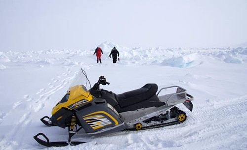
So, while the planes take measurements from the air, team members will be out on the ice taking ground measurements. Apparently it’s about -30°, so it’s going to be a challenge.
I’ll be spending the two weeks out in Alert, based at a military centre. From there I’ll be covering the main activities before nipping back to NL for a week and then heading straight off to Greenland for another leg of the campaign.
NASA are already well into their IceBridge ice survey campaign and things seem to be going well with that. During the campaign, NASA is going to be carrying out several flights for us – underflying CryoSat. This is a great example of cooperation between our two space agencies.
I’m really looking forward to starting the campaign. It’s been a lot of work to organise – we have over 50 people participating from 15 organisations, not counting ESA. So, now actually getting off the ground marks a real milestone!


Discussion: 4 comments
Great campaign!
Why do you use manned plane? Aren”t they very inefficient in a time when UAVs like a Global Hawk is available?
Dear Thomas –
Good point. Unlike the US, however, in Europe we do not have access to large UAVs such as Global Hawk for flying unmanned Arctic missions with our validation instrumentation. Whether or not achieved with UAVs, one also still requires “in-situ” measurement data to first quantify the uncertainties in the satellite (CryoSat) and airborne data – which is really the purpose of this Experiment. Hence people on the ground, and the human ability to respond to regional atmospheric conditions by optimising flight data acquisitions accordingly.
European Space Agency (ESA) is teaming up with Danish, German, Canadian, UK programmes – and of course with US NASA IceBridge activities – to maximise the benefit of measurements using our combined instrumentation, both airborne and satellite-borne . The economy of scale helps achieve things which scientists from single nations are simply unable to do. At a time when the world’s attention is focused on Arctic climate impacts this really is a truly multinational endeavour to respond by quantifying Arctic ice changes.
Thanks for opening up this blog. You’ve got an important and exciting job ahead. I know many professional scientists and those of us who are “armchair” followers of the sea ice, are anxiously awaiting the validation of CryoSat 2 data, and ultimately to getting the first highly detailed continuous measurements of arctic wide of sea ice thickness. The best of luck to you and your team.
I second what R. Gates has said.
Over on the Arctic Sea Ice blog there is and has been a lot of speculation on Arctic sea ice thickness and volume.
Thanks for this great blog.