During the Principia mission Tim Peake published almost 400 pictures of our planet and life in the International Space Station. We know of three ways to to explore his pictures on a world map. They are all worth a visit as each have different scopes and features.
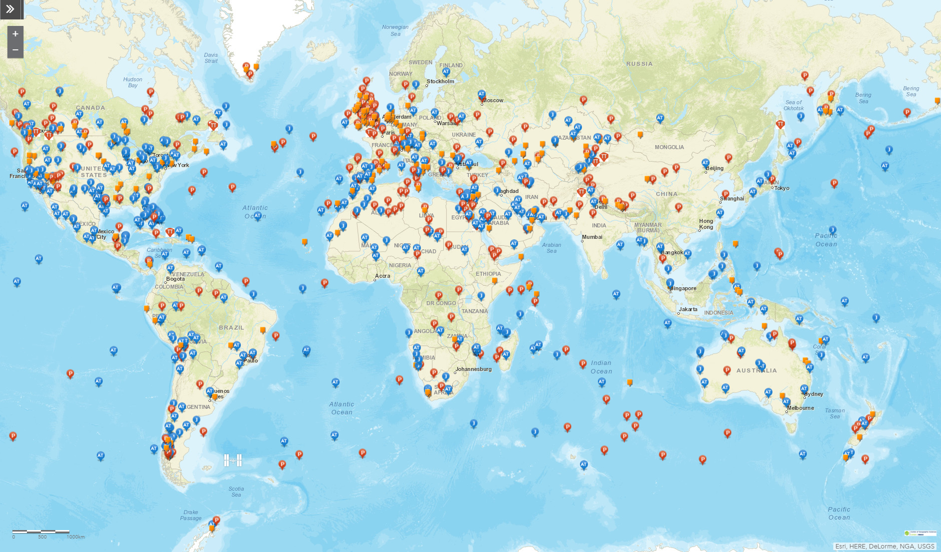 The first we will discuss is made by long-time contributor Dave Maclean who works at the Centre of Geographic Sciences in Canada and is an expert in Geographic Information Systems. His mantra is “a picture is worth 1000 words; a map is worth 1000 pictures; a Geographic Information System is worth 1000 maps”. He creates maps for each International Space Station Expedition with the astronaut’s images of Earth overlayed for you to explore. The maps are used in his courses to show students the potential of Geographic Information Systems and get them thinking about making their own projects.
Dave’s map is by far the most complete offering extra information and including images from Tim Peake’s colleagues – even the images taken by the mini-computer Astro Pi
Hit the link and start exploring: https://isspix.com/iss047
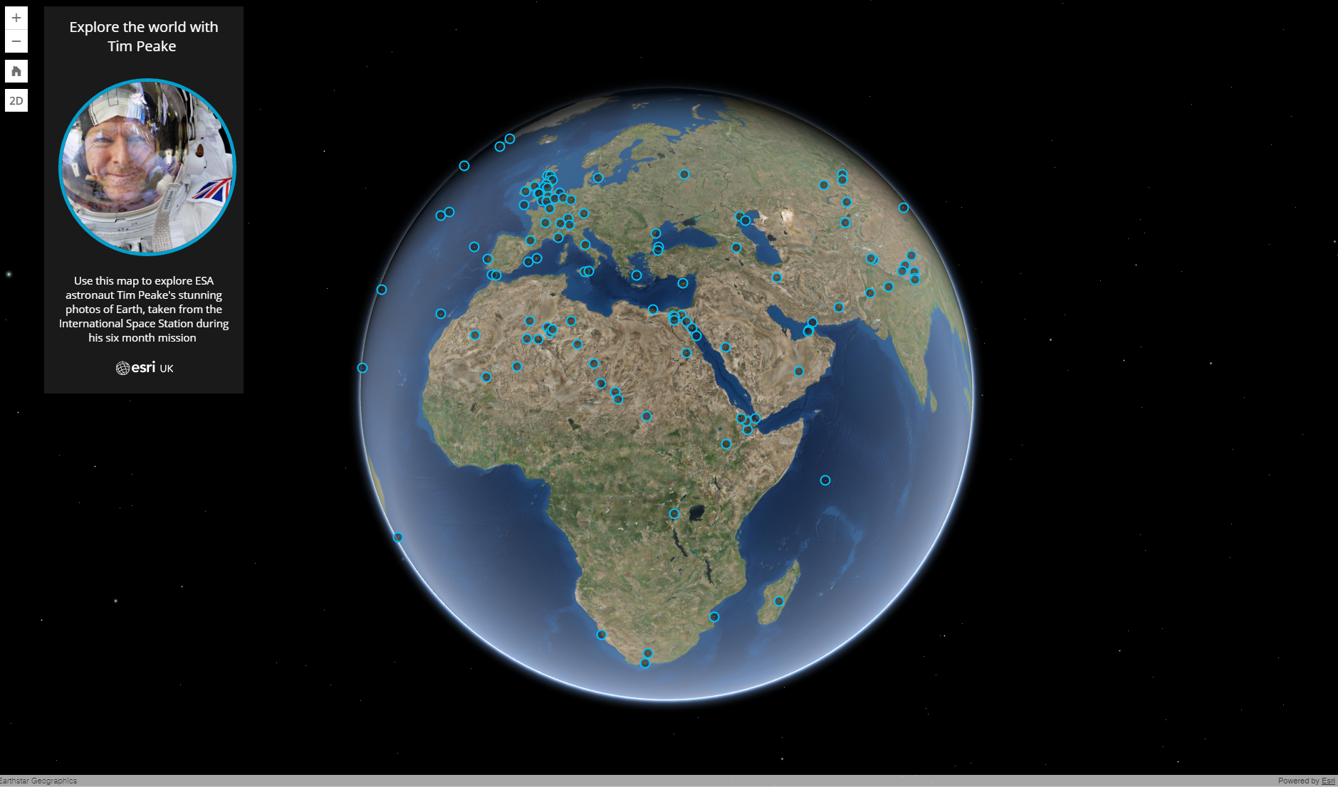
A second option is a map made Esri UK. This map shows only Tim Peake’s pictures of Earth but offers a 3D view and looks incredibly pretty. Check it out at: www.esriuk.com/timpeake
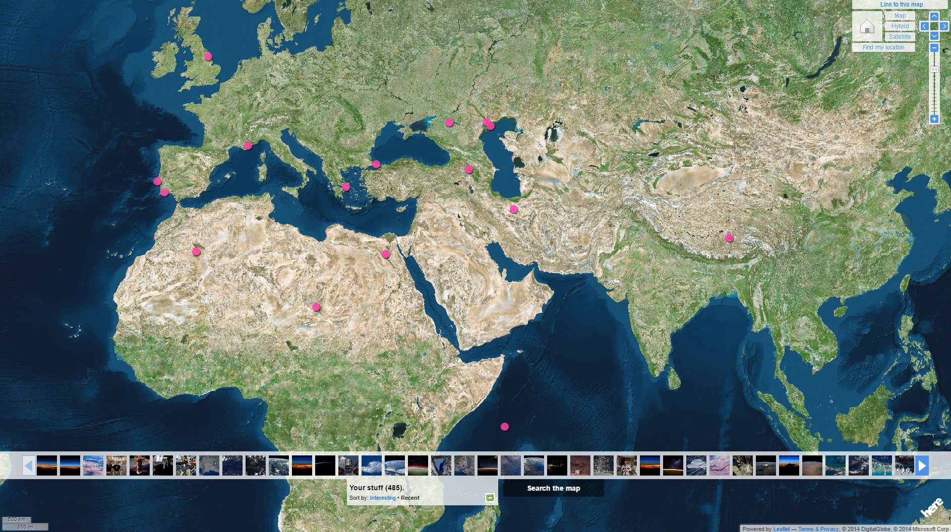
A third option is inside Tim Peake’s own Flickr page under the map section. This version shows the location of every image taken from the International Space Station by Tim Peake. When the image is of a place on Earth it is tagged to the place on our planet. If the image is of the inside of the Space Station it will show at the place it was taken. This allows you to see where Tim was over Earth when he took his famous selfie during his spacewalk. Zoom in and out to discover more markers, or use the images at the bottom to browse. The placements are not 100% accurate as they are dependant on the correct setting of the camera’s time. When a battery is swapped the time might have to be set again by hand so some margin of error can occur.
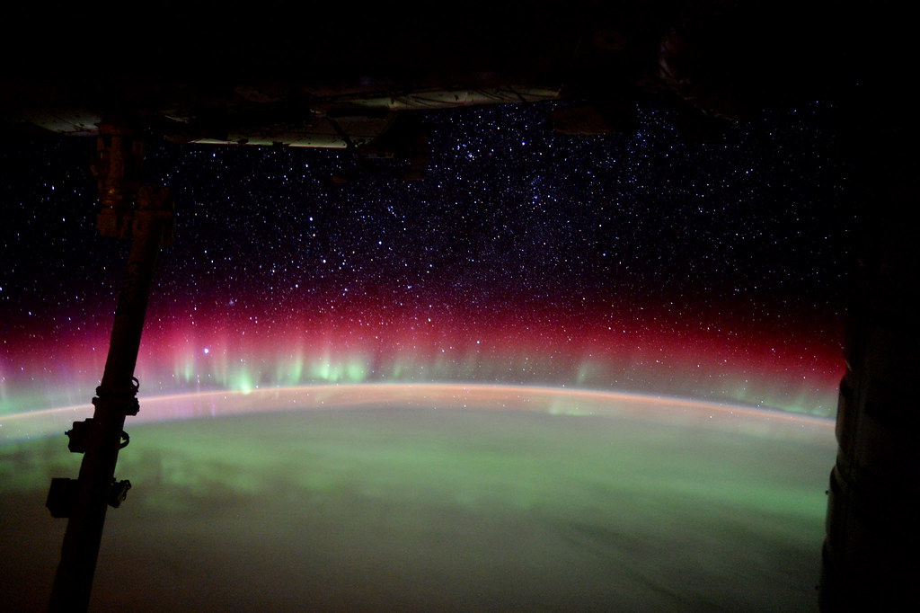
Want to know where Tim was when he took the image below? Click here to find out: https://www.flickr.com/photos/timpeake/map
Of course if you prefer offline browsing be sure to check out Tim’s print book – proceeds go to the Prince’s Trust – here: https://amzn.to/2cEUBK1
Discussion: 7 comments
this is boss!!!!!!!!
Cool
cool!!
epic
landing went well !!!!!!
Fantastic viewpoint!
Great photos
Would you consider a lecture to Winchester Photographic Society? You know the area – not far from Middle Wallop or Boscombe Down!
Sir.
Did you take any photo’s of Hayling Island.?
Kind regards,
Tom Hilton