


With ESA’s Biomass in the latter stages of development, two intrepid scientists are braving the cold in the icy reaches of Antarctica for two months to take measurements from the air and from the ground to help prepare for this new satellite mission.
The Biomass satellite mainly focuses on delivering completely new information on forest height and above-ground forest biomass from space for a better understanding of the state of Earth’s forests, how they are changing over time, and to advance our knowledge of the carbon cycle.
However, Biomass also has a secondary objective: to map the ice structure of ice sheets.
Biomass will carry a fully polarimetric P-band synthetic aperture radar for interferometric imaging. And thanks to the long wavelength of P-band, around 70 cm, the radar signal can slice through the whole forest layer, and penetrate snow and ice.
So, to test how the satellite instrument will work over ice, the two scientists, Jørgen Dall and Anders Kusk – both from the Technical University of Denmark – and team off for Antarctica before Christmas.
Their field work involves installing an instrument, which mimics the Biomass radar, on a Basler aircraft and making numerous flights to take measurements over the icesheet. The airborne instrument called Polaris is a P-band synthetic aperture radar and an ice sounder commissioned by ESA and developed by DTU.
Their task is also to check the suitability of the ice sheet around Dome-C to calibrate Biomass after it is in orbit. In addition, they are collecting data for the ICECAP programme.
Jørgen and Anders have been logging their progress and sent the following feedback:
23 December 2023
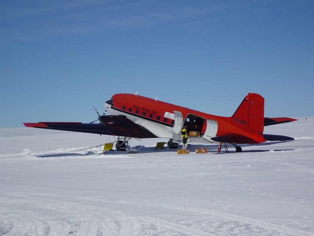
From Hobart to Wilkins Aerodrome with the Airbus 319. Arrived at Casey after an additional three hours and 65 km over the ice sheet with the Terra bus.
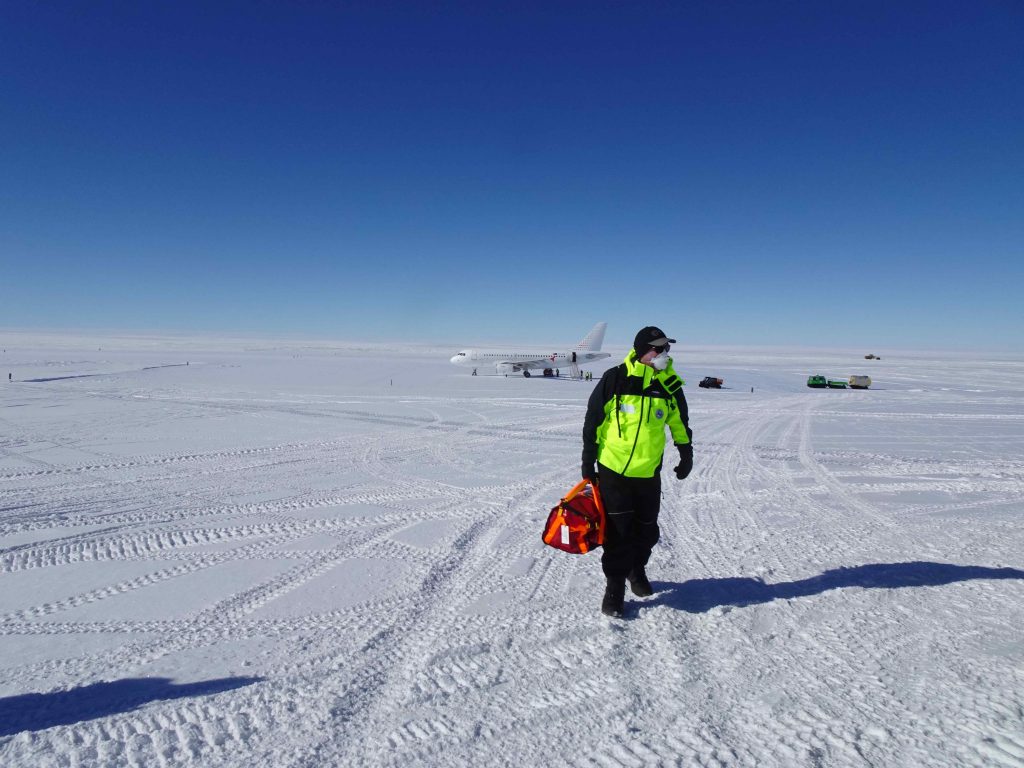
Arriving at Casey. (DTU)
27 December 2023
Today, we finally got access to the Polaris radar and the radar reflector. They arrived with the supply ship, Nuyina, on the 21 of December, but the unloading/loading is a two-week process.
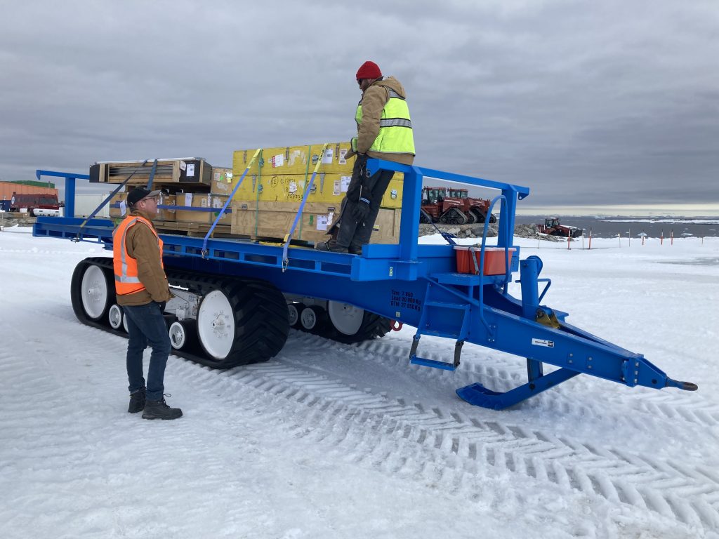
Polaris radar and the radar reflector offloaded. (DTU)
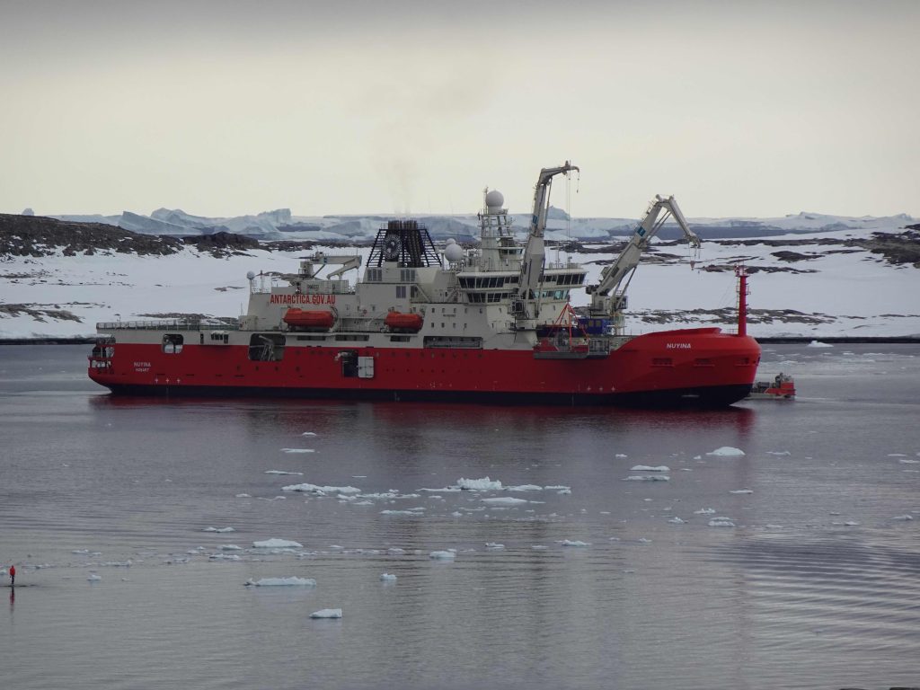
Supply ship. (DTU)
28 December 2023
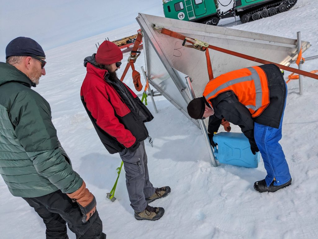
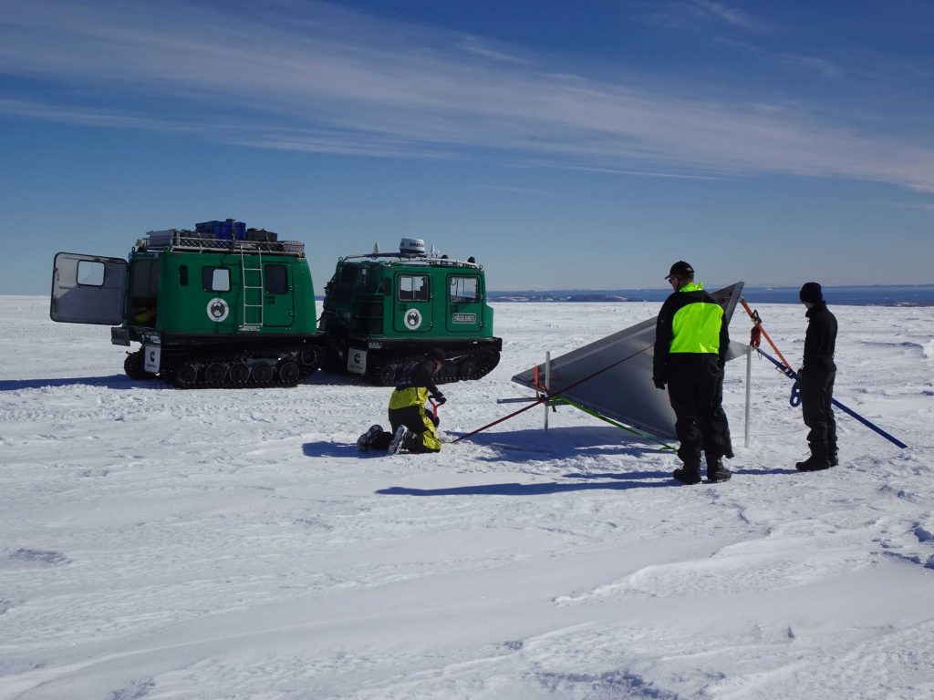
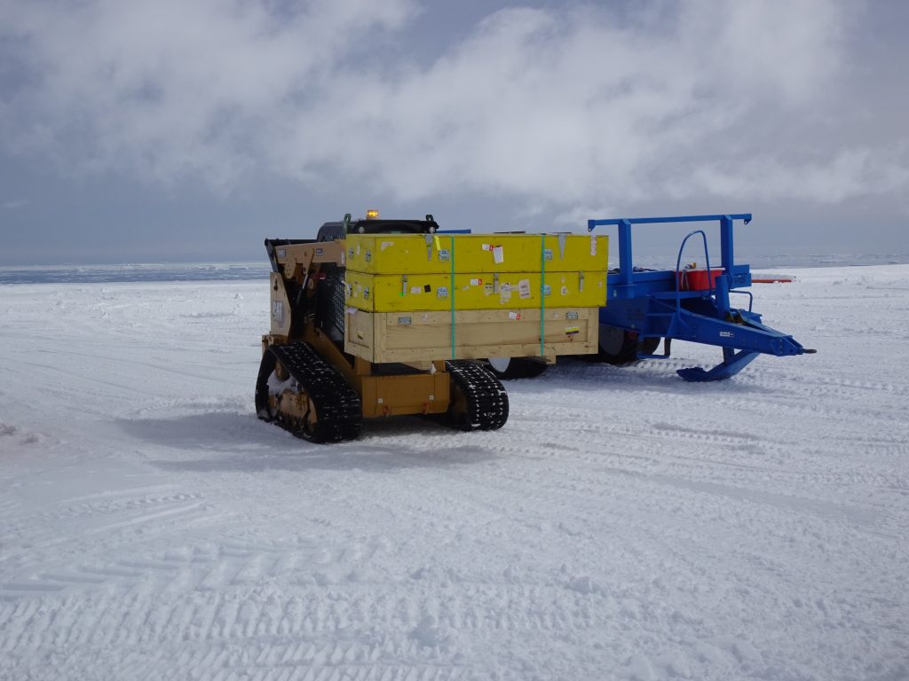
The radar reflector was deployed on the ice sheet about 5 km from the coast, halfway between Casey and the Skiway. The reflector was transported on a sled with one of the four Hägglund vehicles, which are generally used to go to/from the Skiway.
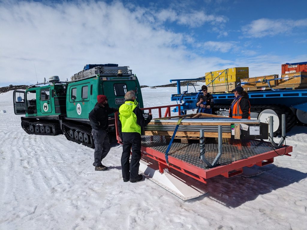
Transporting the reflector. (DTU)
The reflector was mounted on three aluminum poles anchored in the firn.
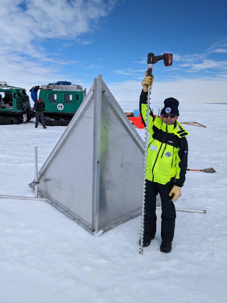
Reflector mounted on three aluminum poles. (DTU)
The poles are fixed by pouring water into the holes drilled in the firn and further secured with Deadman’s anchors and straps.
Pouring water into drilled holes. (DTU)
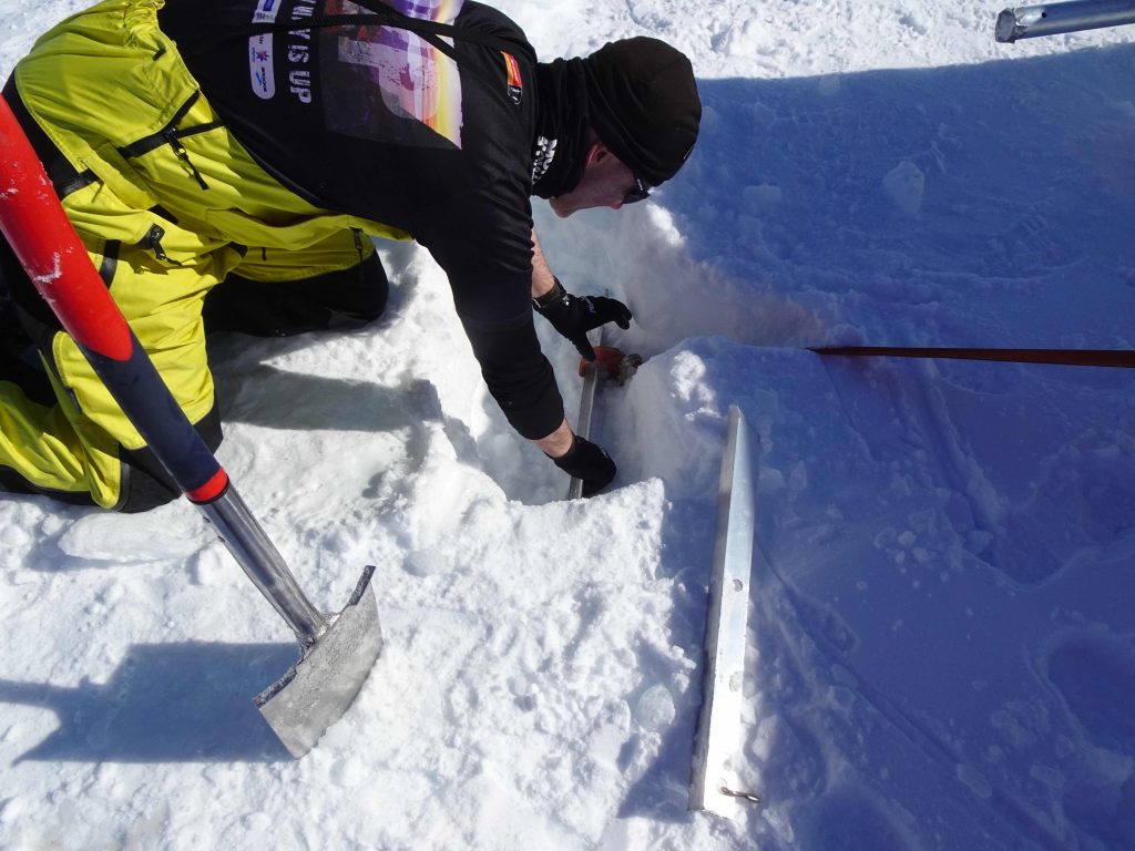
Securing the poles. (DTU)
This is necessary because of the risk of extreme wind speeds. Fortunately, this day the weather was very nice with a beautiful view to ocean and icebergs in the horizon 5 km away from the calibration site.
Fine weather. (DTU)
29 December 2023
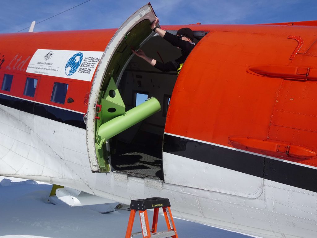
The smaller Polaris antenna was mounted under the fuselage of the Basler aircraft.
Mounting the Polaris antenna. (DTU)
Basler aircraft. (DTU)
31 December 2023
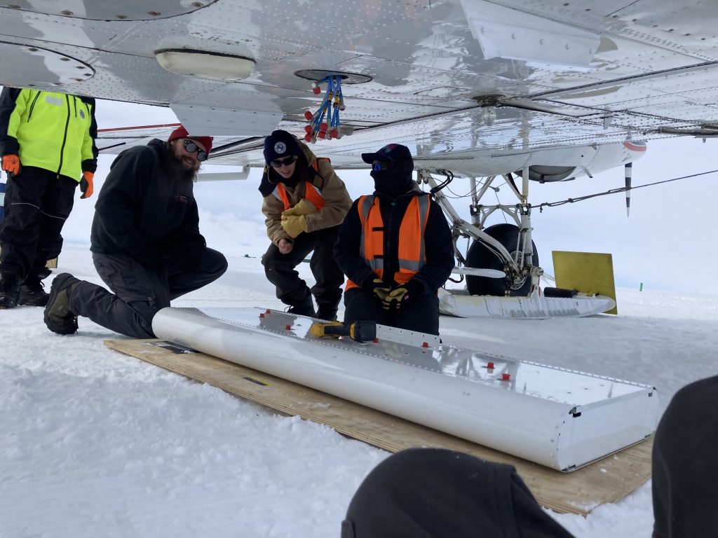
We assembled the larger antenna.
The larger antenna. (DTU)
Two days earlier, it had been taken to an empty container at the Skiway for assembly (one half in each of the two yellow boxes in photo below).
Antenna in boxes. (DTU)
1–3 January 2024
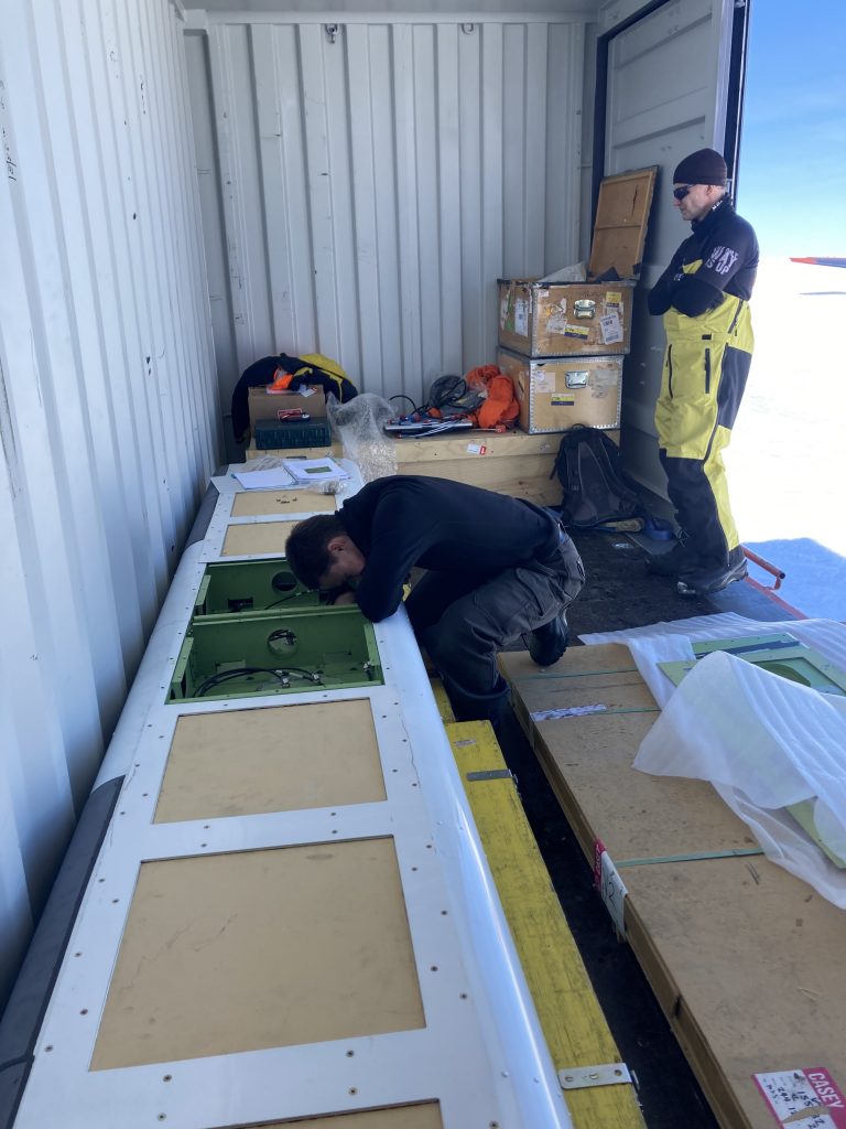
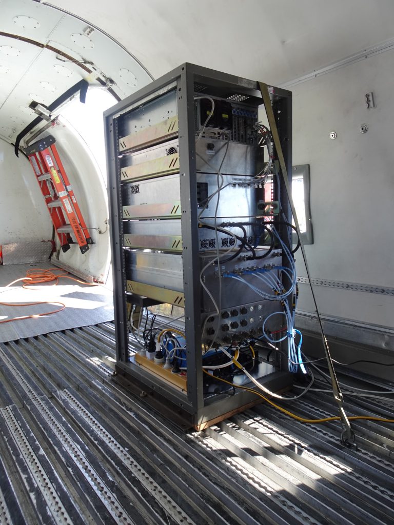
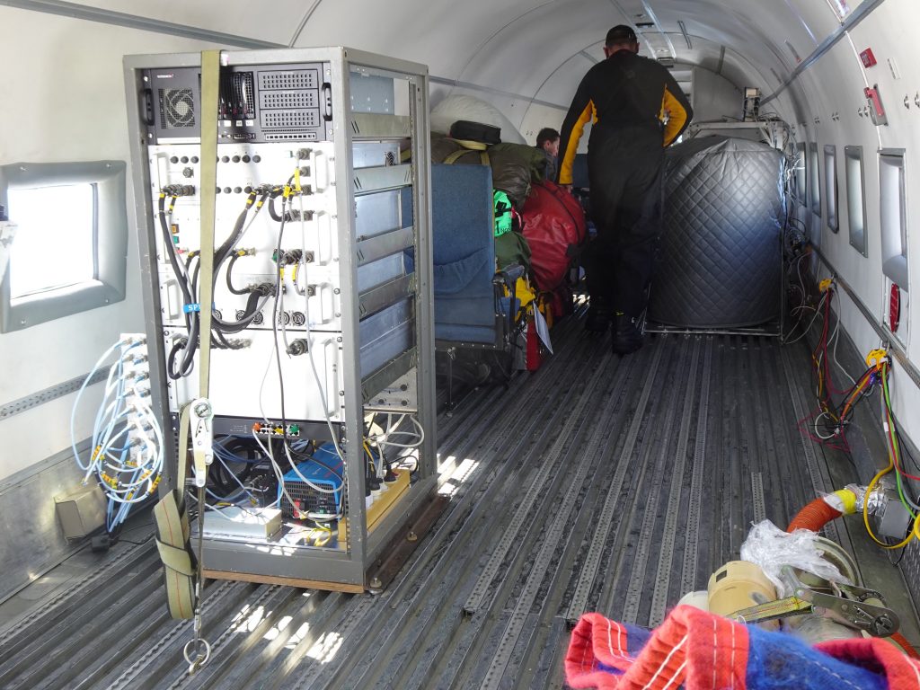
The radar rack was placed in the Basler cabin, the Polaris electronics installed and a GNSS antenna mounted on top of the Basler fuselage. In parallel, the installation of the other ICECAP sensors was initiated: gravimeter, magnetometer, laser scanner, camera, aircraft door for deployables.
ICECAP sensors installed. (DTU)
If you can’t be home for the festive season, then at least new friends are available.
New friends. (DTU)
5 January 2024
As expected, weather prevented us from going to the Skiway for the ground test. With an average wind speed exceeding 60 knots, we had to take precautions when we got out – even when walking from one entrance to another in the same building, e.g., we had to walk accompanied by another person, notify somebody at the destination, and carry a radio.
Blizzard conditions. (DTU)
6 January 2024
Successful ground test of Polaris.
Polaris. (DTU)
7 January 2024
Test flight with Polaris and a subset of the other ICECAP sensors.
First test flight. (DTU)
A lot of survival gear must be brought along with the sensors.
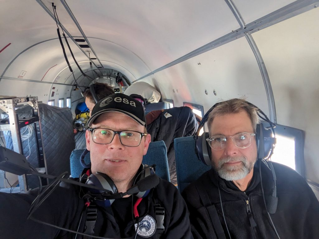
Jørgen Dall (right) and Anders Kusk (left). (DTU)
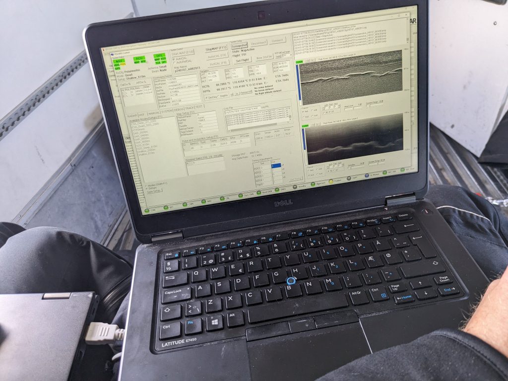
With Polaris in synthetic aperture radar configuration, we flew a racetrack around the radar reflector a couple of times. The radar seems to be working well, but we cannot be sure until we have analyzed the data. Also, we are concerned about the accuracy of the tracks flown.
Signs are good. (DTU)
Some improvement is required for successful acquisition of PolInSAR and TomoSAR data. In the next flight the pilots excellently followed the desired tracks.
As part of the test flight, we also acquired sounder data near Casey, where we again saw the supply ship, this time from above.
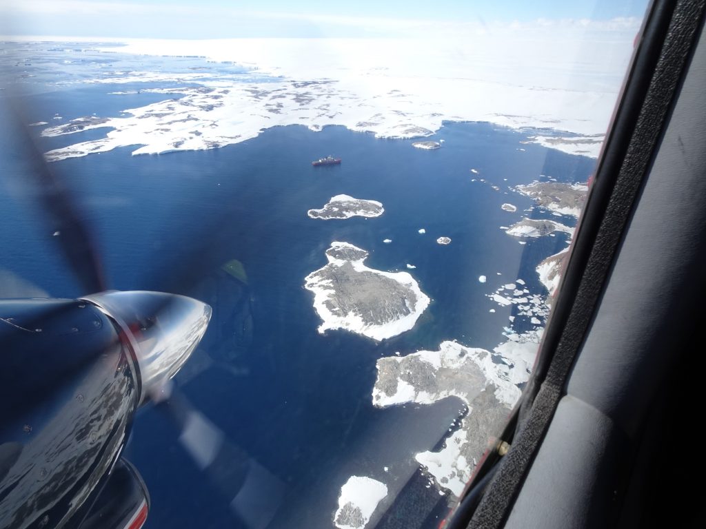
Supply ship from above. (DTU)
We have backed up the data, but not yet applied any processing and analysis.
8 January 2024
The weather prevented us from flying today, and the next two days the operations people are not working, but fortunately we can analyze and process the test data in the meantime.
That’s all for now folks, check back later for updates!
Post from: Jørgen Dall and Anders Kusk. (DTU)
Discussion: one comment
That’s a fantastic adventure ! Can’t wait to know more about the outcomes of processing the test data ! All the best.