


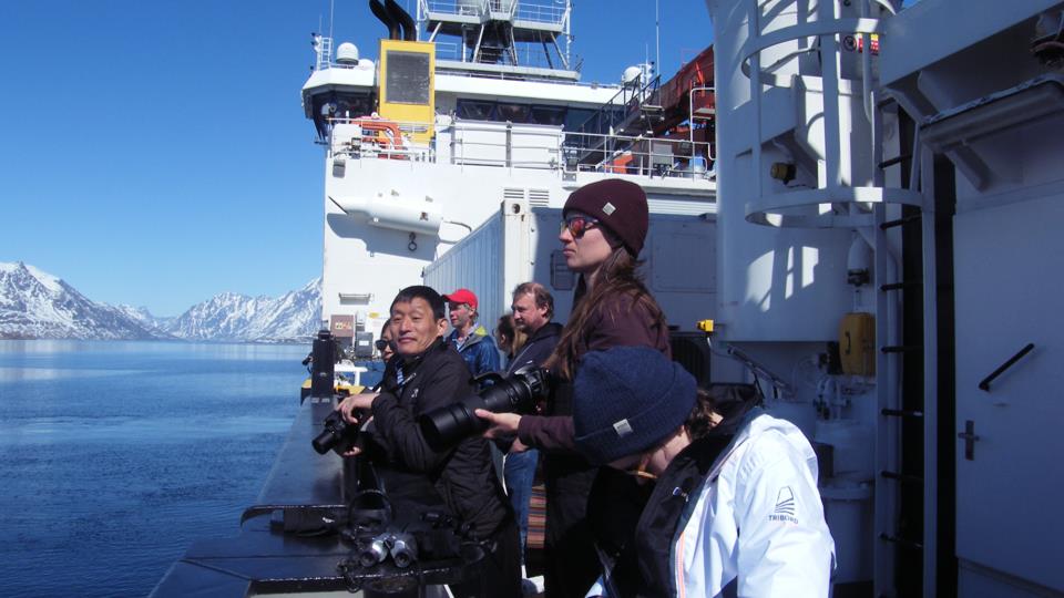
The AMT4CO2Flux project involves a voyage from the UK to the Arctic to quantifying how much carbon dioxide the Atlantic Ocean absorbs and releases and how this may change under increasing climate change effects. To do this, the team is taking measurements to compare to and complement satellite data. This latest post from Plymouth Marine Laboratory’s Gavin Tilstone offers insight into the nature and environment along the coast of Greenland.
East to west coast of Greenland, 26–29 May
Sailing south we encounter large and heavy blocks of ice a drift. It seems like we are in iceberg alley. Huge chunks of ice separated from the sheet and set adrift into the north Atlantic. The wind speed is 40 knots, with a Beaufort force of 7 making the sea surface very rough!
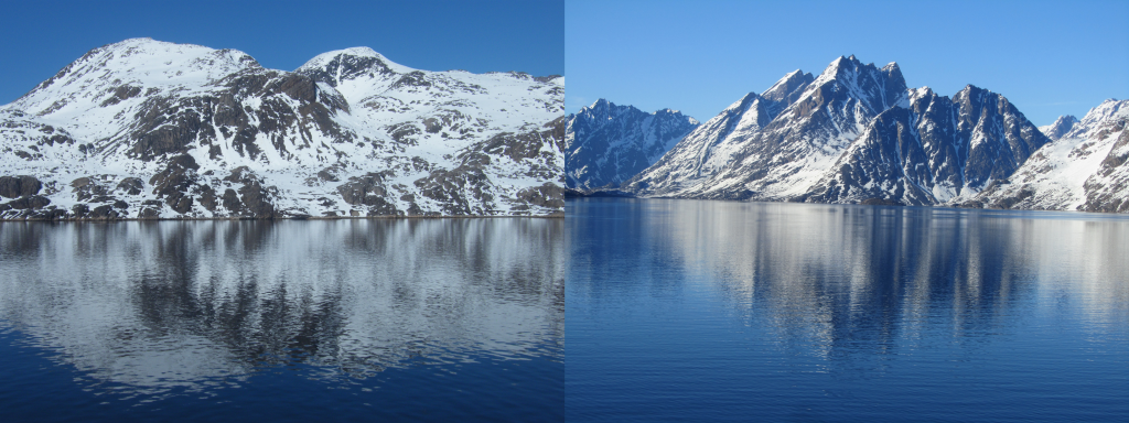
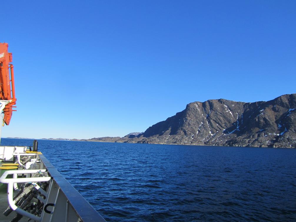
On passage to the main Greenland settlement of Nuuk we pass sculpted mountain crags, some rounded and some sharp, formed by the movement of the ancient glaciers over different rock types. They are majestic and iced with snow like dinner time desert delights fresh from the galley.
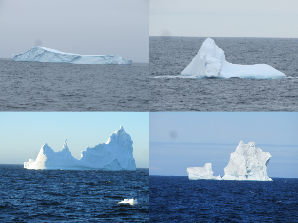
Iceberg alley. (PML)
Nuuk, Greenland’s capital, 30–31 May
We awoke to Nuuk, well at least a mountainside shrouded in mist. We knew that the city was there somewhere in the distance, but the mist hung heavy like a theatre safety curtain concealing the audience from the next act in this Arctic play. On our ship’s time, we were some four hours ahead of Nuuk, so whilst RRS Discovery was a hive of activity, Nuuk was in early morning slumber, no sound and seemingly lifeless. As the Sun rose higher it burnt off the mist layer by layer, and eventually revealed what we had been waiting for, civilisation again.
The town was visible, but not in the guise that I had expected from the tourist websites that depicted it as a quaint alpine village. There was a hotch-potch of coloured a-framed wooden houses scattered up the mountain side, but also and more dominant, were cuboid buildings crammed with small flats, more reminiscent of communist Russia, than an Inuit settlement. There was also a great deal of building works going on. Five or six cranes looming over the town, spreading the settlement a thin strip penned in by the mountainside. Another brick in the ever-expanding wall.
Nuuk is Greenland’s capital and has a population of 17,000. There is a network of fjords around Nuuk, which are famous for waterfalls, humpback whales and icebergs that can be viewed against a backdrop of Sermitsiaq mountain. Being the largest town in Greenland and expanding, with a large proportion of the heating coming from wood and coal, and more ships frequenting the port, emissions from Nuuk are increasing.
We were here therefore, with two objectives; the first under the project SEANA (see blog post DY151 Science Party) to measure emissions from this growing town. The second, under M-Phase (see same blog post), was to potentially capture dust blow from the valley which are potential sources of ice- nucleating particles in air.
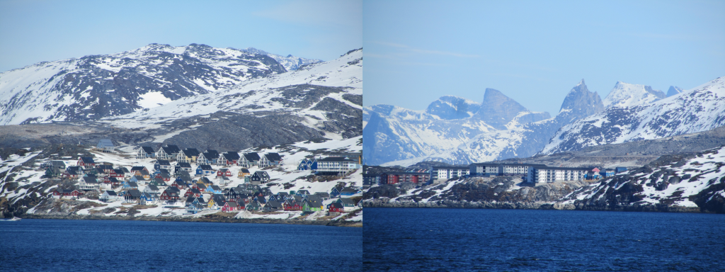
Nuuk from sea, west Greenland. (PML)
Arctic paradise – Amaqooq Fjord, 1–2 June
At 07:00 on the bow and I ascend the 10 m met platform to remove the caps from the radiometers to start measuring the colour of the sea for the day. As I descended, Marshall beckons me over, “Did you see that over there,” he says, pointing to something in the distance. “Whale blow, two or three of them about two furlongs off,” he says. We wait around to see them surface again, but the call of breakfast breaks our concentration. The cruise science meeting followed by the meeting with the captain, poignantly marks the start of day. The Sun is up and the Fjord looks magical.
Amaqooq Fjord. (PML)
After analysing the next scheduled sample for the day, I climb to the bridge to ask the officers to shift the ship 135 degrees to the Sun – a fine balance between quality optics, wind from bow to aft for the atmospheric measurements and the optimum heading for the internet, everyone else’s priority.
From the vantage point of the bridge we see the whales again, this time not the blow, but the low stubby distinctive dorsal searing through the water surface and then disappearing momentarily. I descend back onto the foredeck and message the rest of the scientists, who come scurrying onto the deck like rats being chased by a ferret out of a hole (except for those who are sleeping who have to be physically beckoned).
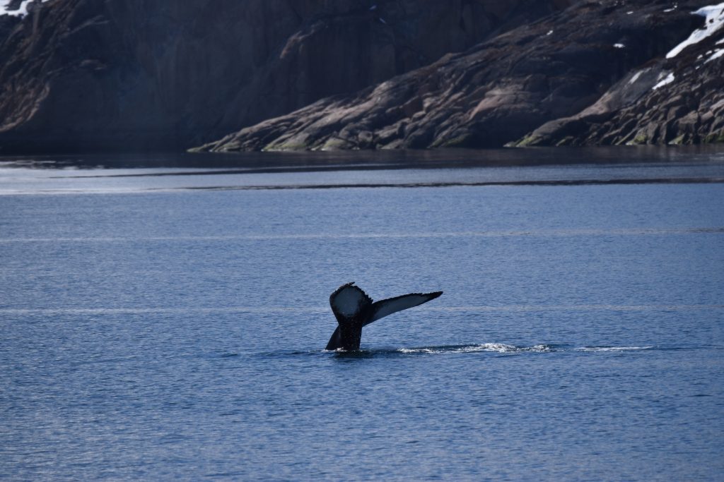
Then the spectacle begins, like a rhythmic sleek and slow dance. Three or four times the dorsal fin appears, then the entire back of this mammoth creature breaks the surface and finally the fluke surfaces like an arrow tip that propels the animal into deeper waters. They dive for six or seven minutes before returning to the surface, to repeat the show again. Plenty of spectators. A full house; the entire science party and many of the crew.
They are humpbacks, a mother and calf and keeping a little more distance another adult. Each of them has a distinctive fluke; the mother is black, but the calf is white with black streaks. Unique recognition features amongst the whale community, probably like facial features or eye and hair colour to humans. When the fluke breaks the surface of the water, it is a spectacular sight, slow and mesmerising. At the same time, it is like the opening of a spring flower at high speed. At its pinnacle, when the fluke is most visible, it is breathtaking and awe inspiring.
Curiously, before we entered the fjord, there was a band of very high chlorophyll-a (phytoplankton biomass) at the coast where the water depth was 230 m. Inside the fjord, the biomass dropped off however, making these deep, 400m plus waters deep blue.
Was it that the phytoplankton had been grazed by zooplankton or shrimps and the whales were attracted here to graze? Or maybe it was the abundant floating bladderwrack seaweed (fucus vesiculosis) that the whales were grazing on? Without profiling oceanographic instruments and nets to capture the zooplankton, this remains a mystery.
They circle around the ship well into the afternoon. Like excited children we move from the foredeck to the aft deck to follow them as they swim further towards the entrance of the fjord and the open sea. Later that evening at dinner, there is not just a buzz about the whales, but the atmospheric guys have witnessed new particle formation in the air mass above these pristine waters; a rare event I am told!
The next day we move further into the fjord to a backdrop of snow-capped mountains that loom like megaliths in front of the ship. The whales are with us for most of the day again. In the evening, my daily ascent of the met mast to clean the radiometers, and the whales appear again, but closer than I have seen before.
Nick, who is on the bridge with the Third Officer Graham, has also spied them. As I descend the met platform, he also descends from the bridge. We watch in awe as not two but three humpbacks cross in front of the bow and make their way to a new feeding patch directly opposite us to continue their mesmerising dance or arching until they dive. A sight to behold, that turns out to be one of the best of the voyage.
Humpback Whales (Sarah Barr, University of Leeds)
Science party watching Humpback Whales. (PML)
North to Sisimuit and the Davis Straits, 3–5 June
We steam north early the next morning. For those up early enough, the last sight and sounds of the fjord as we cruise out of this sacred place. Back in open water is a jarring change, as the ship gets whipped back and forth by the swell. By evening we reach Sisimuit Fjord, but stay only at the mouth as this area is uncharted and the captain cannot therefore risk taking the ship further in.
At dawn, the sunrises fast bathing the landscape in red to pink to orange hues. There was a stiff breeze in the air ruffling the water around us. In contrast to Amaqooq with prominent tall mountains, the surrounding landscape is stunted and rounded of pillow larva made from cascades of volcanic larva as it piled up and cooled away from the main larval flow. As the Sun reaches beyond zenith, the rescue boat is launched and with it, Sarah, Loren and Katie to collect river water samples to test for ice nucleation. We stay until early evening to watch a full cycle or the ebb and fall of the tide as we set sail once again with the red and white Greenland flag on our mast. As we leave Sisimuit and night draws in, we head straight into rough weather. A bumpy night, especially for those on the upper decks.
By the next evening we arrive in the Davis Strait opposite Disko Island. Conditions are calmer here and the water depth is only 200 m. We are on the Greenland shelf. Like at Amaqooq, the phytoplankton is low, indicative of being grazed out. All day we see fishing boats trawling the area, like tractors harvest wheat and corn. We find out from the officers on the bridge that these are indeed shrimp and prawn trawlers, with another factory ship lying close, ready to process the days catch and to whisk it off to market.
Sisimuit Bay. (PML)
Onto the Ice 6–13 June
On 6 June, we steam west in the full blaze of the Arctic Sun and some 20 hours later we reach the western ice edge again. The ice on this side looks different to that on the east coast, which has been exposed to the full force of the Atlantic. On the west, the ice is more protected by Greenland to the east and Canada to the west. With the warming of the summer, it cracks and opens like a fissure, separating the two land masses with a ravine of open sea that rushes in from the south. The ice here is in larger solid blocks and resembles cracked earth baked under the Sun. It is more concentric than the watery porridge-y undulating mass that we saw on the east coast. It peels off in long lines, like a wave of centurions sent out to ward off intruders by the main military force, the unbroken fortress of ice that still stands firm at the coast. There are fishing trawlers out here to, which plough through the sea ice, to break it up and make the net easier to land.
For two days, the Sun is bright and piercing, creating a striation of blue hues from sky to ocean dotted by floating white in many different shapes and guises. For the atmospheric scientists, this is heaven. A pristine air mass blown over the ice from the northwest creating the formation of new particles with no atmospheric influence. This phenomenon is rarely seen over the Arctic.
The question is does it arrive closer to the ice, or in the melt water? The crew launch the rescue boat to find out so that we can work a line form the ice edge back east and southeast to find out. In the rescue boat you are closer to the water and the ice and appreciate this melting phase as far as the eye can see. Mint bottomed ice masses with white fluffy crusts everywhere. It is a spectacular sight.
For me also, the only oceanographer it is also a haven. The phytoplankton is rich, perhaps caused by a fresh release of nutrients from the shedding ice. The colour of the waters are mazey; aqua-green speckled with white – a combination I have not witnessed before.
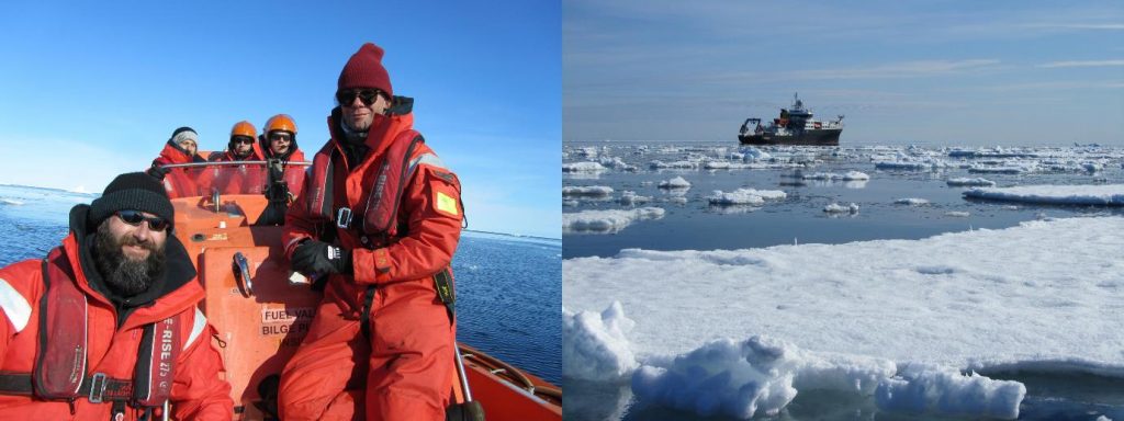
The rescue boat launch at the ice edge. (PML)
We stay a further four days at the ice-edge, but slightly southeast of our original arrival point. It is like a completely different place. The phytoplankton is grazed out and the bright blue sky and ocean turns into a melancholic overture of greyish tones, created by evaporation from the melting ice, freezing mist and fog merging into thick heavy and dense cloud. The landscape is transformed from blue-black with polka-dot ice to simply grey. The air is so cold it freezes on the radiometers producing a sea-serpent-like tail that writhes around the cables.
I am out here to measure the colour of the ocean, which changes as the phytoplankton grow and become more productive. In turn, this productivity by the marine plants draws down carbon dioxide from the atmosphere and releases oxygen for us to breathe. More than a fourth of the carbon dioxide emitted by humans is taken up by the oceans, which have also absorbed 90% of the excess heat. The Arctic is one of the richest areas in phytoplankton on the planet. Global warming could change that and with it, the capacity of the oceans to balance the carbon dioxie that we emit, which could trigger warming of the planet beyond anything witnessed in our lifetime to date.
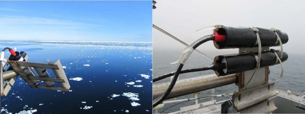
Seabird radiometers in Arctic conditions. (PML)
Post from: Gavin Tilestone, Plymouth Marine Laboratory
Discussion: no comments