


The AMT4CO2Flux project is quantifying how much carbon dioxide the Atlantic Ocean absorbs and releases and how this may change under increasing climate change effects.
Mobilising for a research cruise takes months of preparation. From building, assembling and testing all of the equipment, ordering all of the necessary consumables, to experimental planning, health and safety risk assessments, sea survival training, seagoing medical and dental checks. We will be working in remote areas of the ocean for a six-week period, so we need to be well stocked with spares and prepared for any eventuality if equipment fails or breaks down. The preparation for this campaign started three and a half months before the actual boarding date.
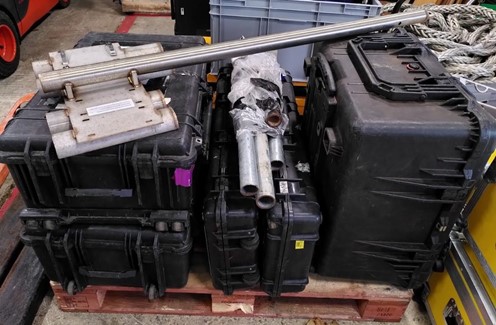
Packing equipment at Plymouth Marine Laboratory ready for transport to Southampton. (credits: PML)
Since RRS Discovery will be doing another research cruise before ours, all of the equipment was boarded at the National Oceanography Centre dock in Southampton in early April 2022 under the guidance of Jon Short, the National Marine Facilities research cruise programme manager. With Covid restrictions still in place on UK research ships and the need for crew and scientists for the other research cruise to be in an isolated bubble, we were only allowed to install equipment on the exterior of the ship. With seven institutes from the UK and internationally joining the ship, Jon scheduled separate days for each institute to install equipment. All other equipment was placed in a palleted cage and safely stowed in a container, craned aboard ready for unpacking and mounting in Reykjavik, Iceland.
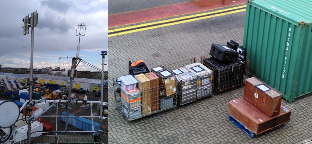
Installation of equipment on RRS Discovery meteorological platform in Southampton dock and the remaining equipment palleted and stored on board for mobilisation in Reykjavik. (credits: PML)
Reykjavik port
After 10 days in self-isolation and 12 days of PCR and lateral flow testing for Covid, we boarded the ship on 16 May 2022. Prior to boarding there was one further lateral flow test to ensure that all scientists and crew were free from the virus. Inside spaces of the ship, face masks are still worn, and mealtimes are socially distanced.
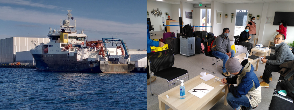
RRS Discovery in Reykjavik port and final lateral flow tests before boarding. (credits: PML)
Once aboard, setting up of the instruments and laboratory could proceed. As mentioned above, much of the AMT4CO2Flux equipment is installed on the meteorological platform located on the foredeck. It includes the following instruments: above-water radiometric optical sensors (HyperSAS radiometers) that measure upwelling radiance from the sea surface for the validation of the Copernicus Sentinel-3 mission’s ocean colour measurements; infrared radiometers (ISAR) that measure the skin temperature of the ocean used to validate satellite sea-surface temperature measurements; C-band radar which characterises wave properties and surface roughness that are used to validate observations by the Copernicus Sentinel-1 mission; eddy covariance sonic anemometer plus instruments that measure the carbon dioxide concentration in both air and seawater to characterise the gas flux of carbon dioxide between the ocean and atmosphere.
The meteorological platform has a clear and unimpeded view of the sea below and the instruments are installed to maximise the view of the ocean or sky with minimal interference from the ship’s super structure.
A key part of the AMT4CO2Flux is that estimates carbon dioxide flux are being made using satellite data. These estimates are then ‘sea truthed’ using the carbon dioxide flux measurements made on the ship. Once the accuracy of the carbon dioxide flux estimates have been verified, synoptic maps of the carbon dioxide flux of the ocean can be produced. The global ocean currently absorbs about 25–30% of the carbon dioxide that humans emit, but under the shadow of climate change and increasing global temperatures, this could be reduced in the future.
The AMT4CO2Flux project is quantifying how much carbon dioxide the Atlantic Ocean absorbs and releases and how this may change under increasing climate change effects.
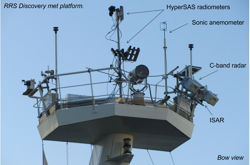
AMT4CO2Flux instrumentation on RRS Discovery meteorological mast. (credits PML)
After completing the set-up of the equipment on the meteorological mast, the container was unpacked, and the numerous boxes were carried into the lab spaces to be installed on the benches. For this voyage, the AMT4CO2Flux team alone had 40 shipping boxes, each of which had to be carefully unpacked and its contents installed in the ship’s laboratory.
The process not only includes installing the instruments, pipework and plumbing, laying electronic and internet cables, setting-up computers and power supplies, but also ensuring that everything is tightly lashed and secured for rough and stormy weather. The equipment in the laboratory is for measuring the optical properties (both absorption, backscattering and attenuation) of phytoplankton, other particles and dissolved material. These data are not only converted into phytoplankton biomass (Chlorophyll-a) to provide very high-resolution measurements for the validation of satellite ocean colour observations, but also provide data to improve satellite ocean colour products in these under-sampled regions of the Arctic Ocean. After three days, the work was completed, and we were ready to set sail.
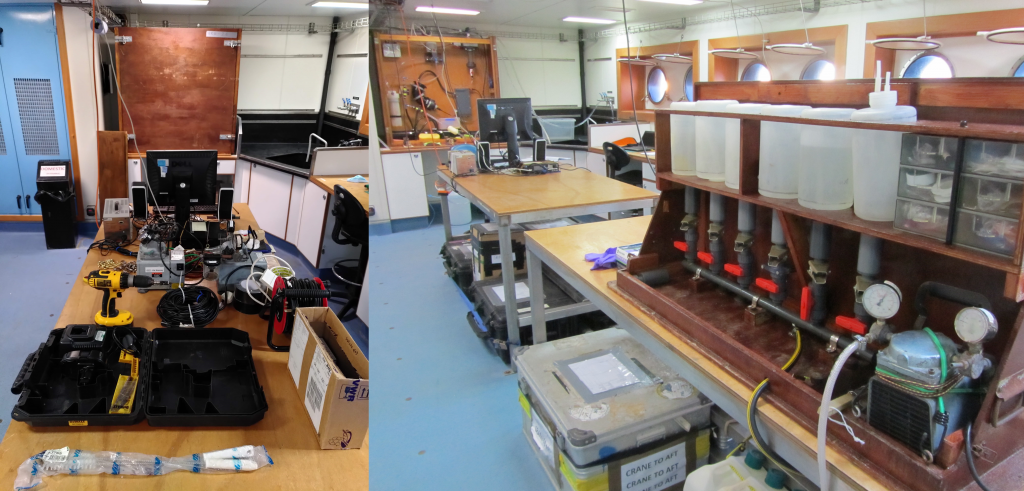
Unpacking boxes and laboratory set-up of optical equipment for high resolution measurements of phytoplankton biomass and other optical properties. (credits: PML)
Impressions of Iceland
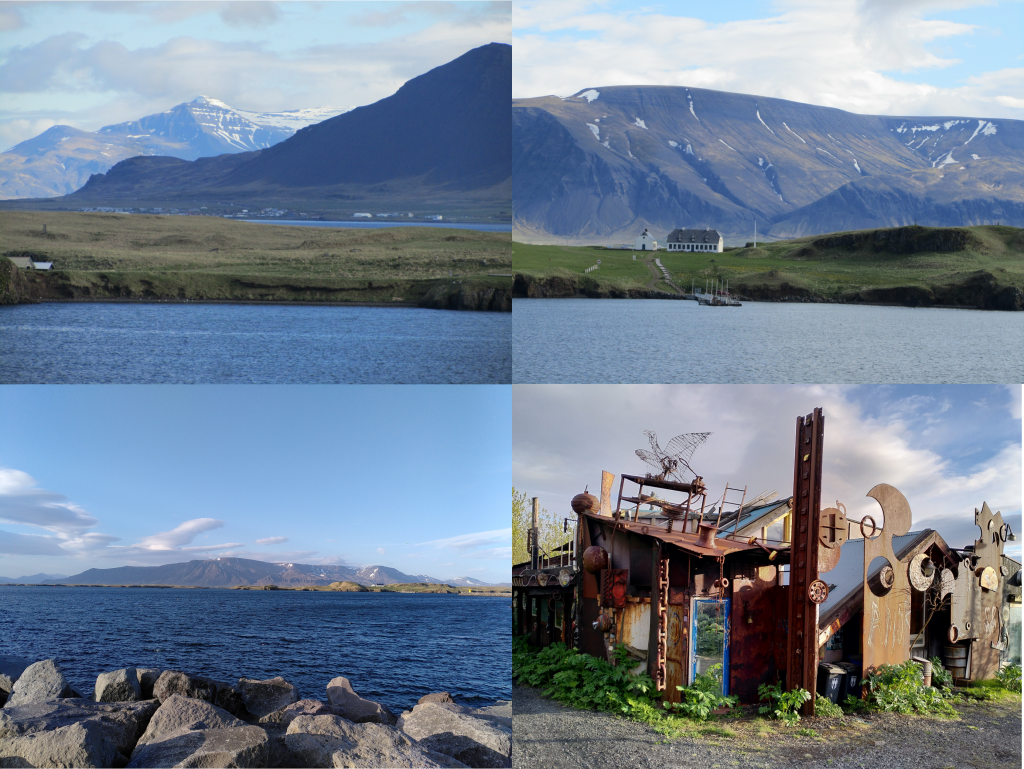
Iceland has a population of approximately 360 000 people. The city of Reykjavik houses around two thirds of the population. The port is a few miles to the southwest of Reykjavik, nestled on the banks of the Grafarvogur inlet. It is surrounded by ice-capped hills and mountains and quaint and picturesque Icelandic villages and buildings. The port houses the typical car, truck, heavy plant, grain, and containerised transport, but in contrast to Southampton, it is a quiet and scenic area with few ships entering or leaving.
From the port you can take a ferry over to the neighbouring Videy, a typical small Icelandic settlement surrounded by prominent snow-capped mountain crags. The port is a maze of gated compounds but with several well planned and scenic walkways that weave through the area taking you along the water front or through wooded glades and ponds. As you head from the port back towards the city you pass the Sigurjon Olafsson maritime museum.
Views from Reykjavik port. Bottom right: the recycled house built by the famous Icelandic director Hrafn Gunnlaugsson. (credits: PML)
One of the striking and less well-known buildings that you pass is the recycled house built by the Icelandic film director, Hrafn Gunnlaugsson. The building is nestled on the approach to the port next to the sea. It is made of numerous metallic maritime and urban artefacts, rusted and aged by sea salt to give the house a red ferrous paint work. There is a covered shrine by the water’s edge of the Norse Goddess Freije, the Goddess of fertility.
The final part of mobilisation was re-fuelling of the ship for the long voyage ahead.
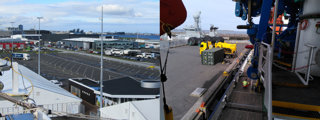
Views of Reykjavik port from RRS Discovery and re-fuelling for the long voyage ahead. (credits: PML)
Post from: Gavin Tilestone, Plymouth Marine Laboratory
Discussion: no comments