


We are in the north of the Netherlands, on the Frisian Island of Texel, for an experiment campaign that involves flying over the Wadden Sea, which is a shallow body of water with tidal flats, sandbanks and wetlands.
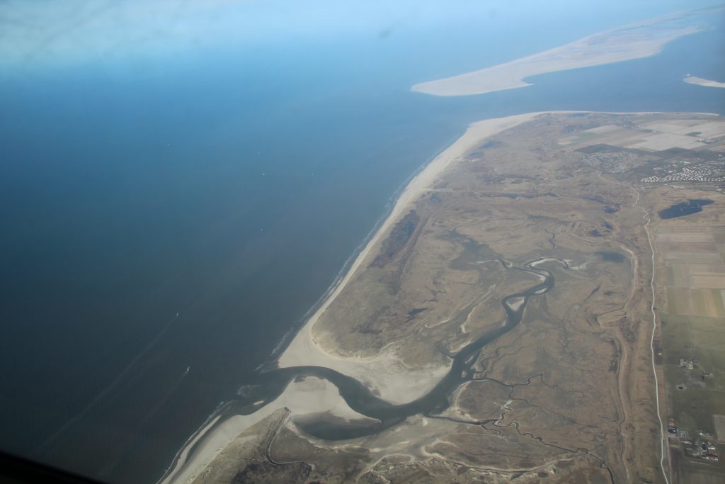
Texel, NL, from one of the WaddenSAR campaign aircraft (ESA–Kubanek)
The aim of the campaign, called WaddenSAR, is to support the development of ESA’s Harmony Earth Explorer satellite mission.
Harmony was recently selected to enter ‘Phase A’ of development as ESA’s tenth Earth Explorer mission.
The Harmony concept comprises two identical satellites that would fly in convoy with a Copernicus Sentinel-1 satellite. Each Harmony satellite is being designed to carry a receive-only synthetic aperture radar as its main instrument. The concept is that they will work with Sentinel-1’s radar, by receiving the Sentinel-1 signals. Harmony would provide data to measure small shifts in the shape of the land surface such as those related to earthquakes and volcanic activity, thereby contributing to risk monitoring. It would also allow for the study of 3D deformation and flow dynamics of glaciers at the rapidly changing marginal zones of the ice sheets for a better understanding of sea-level rise. In addition, Harmony would help to map and quantify upper ocean surface processes including winds, currents and swell.
Both Harmony satellites would also carry a multibeam thermal-infrared instrument, which in the presence of clouds will enable the measurement of height-resolved cloud movements. In absence of clouds, this multibeam thermal-infrared instrument will measure differences in sea-surface temperature.
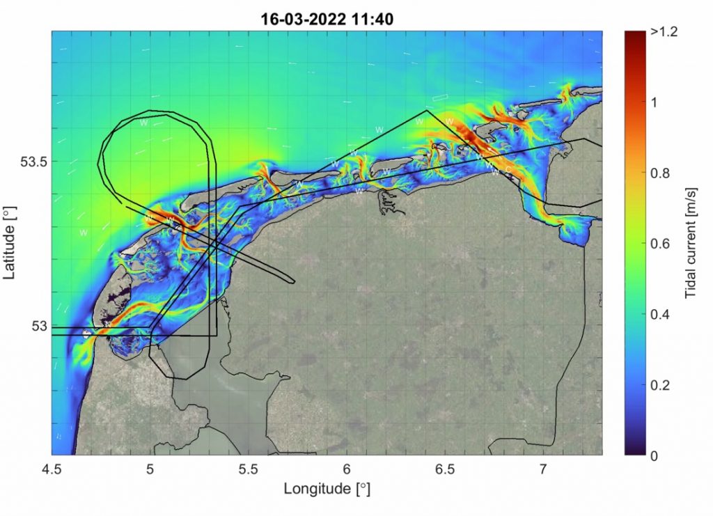
WaddenSAR flight paths and tidal currents (Firmijn Zijl, Deltares)
As part of the mission’s development, our WaddenSAR campaign, carried out by MetaSensing, involves two aircraft – each carrying a C-band synthetic aperture radar (SAR) instrument and flying in ‘bistatic’ along-track formation over the sea. Bistatic along-track formation here means that one of the aircraft will fly in front of the other, both aircraft’s instruments will be able to receive the radar signal and one of the instruments will also emit. This configuration will simulate the transmit–receive arrangement between Sentinel-1 and one of the Harmony satellites.
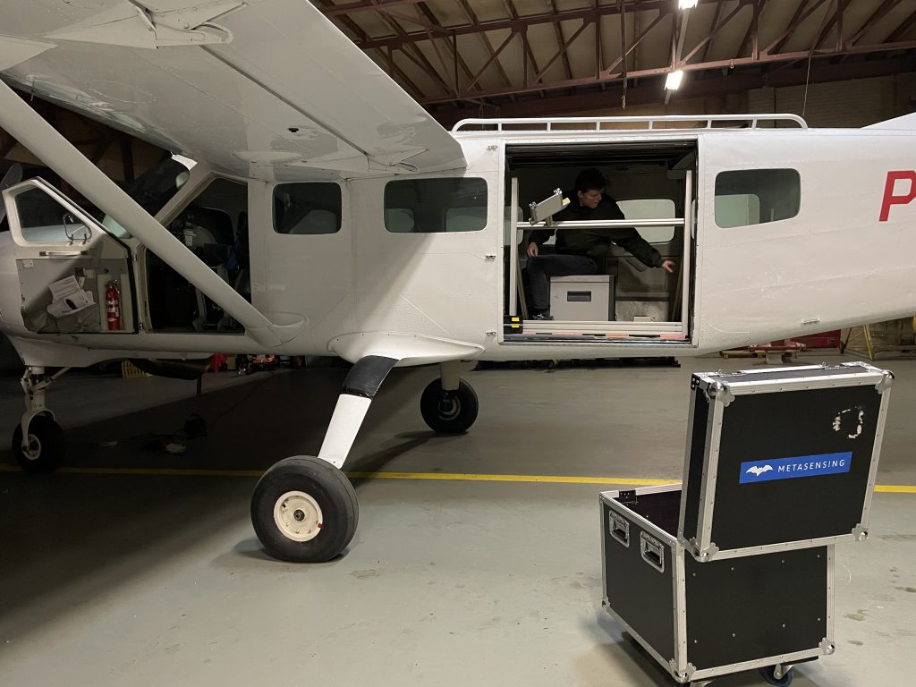
Preparing one of the aircraft for the WaddenSAR campaign (ESA–Kubanek)
The test area is the Dutch Wadden Sea and further north, up to the Frisian Front (around 54°N) to capture ocean fronts and eddies.
Many thanks go to scientists from Deltares, an independent institute for applied research in the field of water and subsurface, and from the Royal Netherlands Institute for Sea Research who are supporting the campaign, and to the Technical University of Delft, who are going to be processing and interpreting the data.
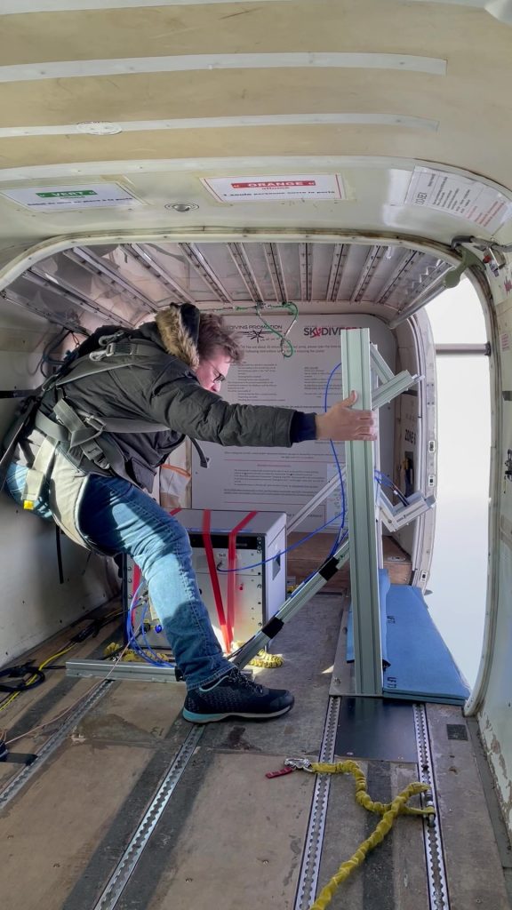
Bit of physical effort required in preparing one of the aircraft for the WaddenSAR campaign (ESA–Kubanek)
We are hoping for good weather and a great campaign to further the Harmony mission, which will shed new light on many aspects of our planet.
Post from: Julia Kubanek, ESA Earth Observation Campaign Scientist
Discussion: no comments