


Should we stay or should we go … from Indriði Einarsson and Henriette Skourup, DTU Space
On 1 May, we arrived in Thule AB, which is the closest and most convenient airport for flights to Devon Island. Grisefjord in Canada is actually closer to Devon, but the runway is often hampered by strong cross winds which makes landings impossible.
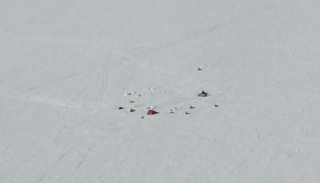
Summit camp Devon Ice Cap
On Devon Ice Cap the ground team from the Geological Survey of Canada and the University of Alberta was already established in a camp near the summit (see photo) and the corner reflectors were in place. The plan was to survey along two CryoSat ground tracks of 3 May and 22 April and to re-fly flight lines (line 623 and 450) from campaigns in previous years (see map below).
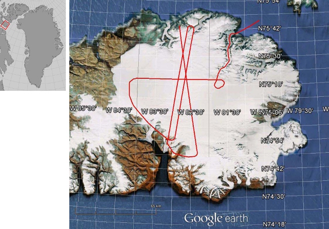
Devon Ice Cap and planned flight tracks
On the morning of 2 May all the instruments were up and running and the weather was perfect with clear blue skies and a light breeze from the northeast. Everything was ready and perfect, and with hindsight maybe a bit too perfect. When starting the aircraft engine the electrical system failed and the silence spoke its own words. The airport’s hours of operation are strictly limited to 08:00–16:00 local time, which leaves only a small window for delays in the flight plan. As the time passed by the hope for a Devon flight for that day quickly faded. Nevertheless, thanks to the huge effort from the crew and local mechanics the aircraft was ready in the afternoon. According to the Met Office, the weather looked promising for a second attempt the next day.
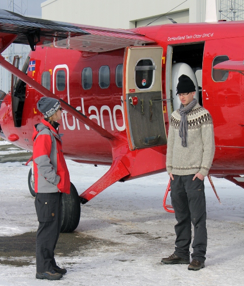
Work in the Arctic demands patience - Sine and Indriði from DTU
Unfortunately, the satellite image for the area on the morning of 3 May showed low clouds covering the ice cap. We have the indispensable possibility of calling the scientists on the ice cap for the local weather. A call at 09:00 to Dave Burgess (from Geological Survey of Canada) working on the icecap could not, however, provide a definitive answer to the question: “Should we stay, or should we go?” He reported clear sky at the summit, but thick low clouds to the Northeast and East. We decided to wait another hour to see how the weather developed but in a second phone call we were told that the weather hadn’t changed.
With the weather prediction for the next day in mind, 50/50 chance for good conditions, a decision was made to give it a try. We took off in flurries from Thule AB. As the flight to Devon in a Twin Otter takes about 1.5 hours, there was plenty of time to ponder about the weather situation on the ice cap.
The hopes grew, as there were some clearings outside Thule AB, and fortunately, Mother Nature was in a good mood. The weather on the ice cap was perfect and all the planned tracks were flown, including the CryoSat track, and the corner reflectors at summit were right on spot.
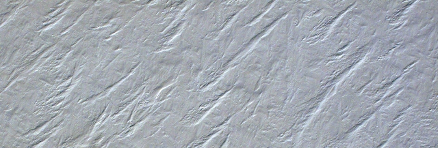
Snow structures from wind erosion on Devon Ice Cap
With Devon Ice Cap done, the CryoVEx 2012 main validation sites were covered, and we only had to return to Kangerlussuaq where the IceSAR team was waiting for the Twin Otter to repeat tracks from mid-April (see blog posted on 26 April). We left Thule AB on 4 May between heavy flurries. On the way to Kangerlussuaq we used the opportunity to measure the sea ice in Baffin Bay and the Greenland ice sheet along a CryoSat ground track.
The CryoVEx 2012 airborne campaign has been a success and we have been quite lucky with the weather both at the validation sites and on most transit flights. We have gathered airborne data along 16 CryoSat ground tracks covering different sea ice conditions, parts of the Greenland ice sheet, as well as the local ice caps Devon and Austfonna. An overview plot of all pre-processed laser scanner data acquired during the campaign is shown in the map below.
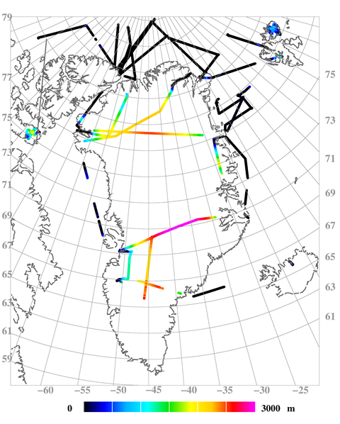
Heights from pre-processed laser scanner data from CryoVEx 2012
Discussion: no comments