


From Indridi, Sine & Henriette (DTU Space), on the way to Thule Airbase, 29 April
Continuing our campaign to validate CryoSat, the last days of April were busy. We flew over the Austfonna ice cap on Svalbard to measure Kongsvegen Glacier and the sea ice in Fram Strait on the way to Station Nord, the most northeasterly habited point in Greenland, and we underflew CryoSat t over the sea ice north of Greenland.
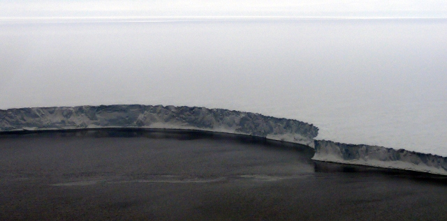
Ice cap meets the sea
At the Austfonna ice cap the ground team from University of Oslo and Norwegian Polar Institute had put up five corner reflectors prior to the flight. These are used as a reference point to validate the penetration of the radar signal in the upper layers of the ice cap, and to check the timing of the ASIRAS radar.
We had fairly good weather conditions over the ice cap with just a few low clouds in the west and northwest. Although the laser scanner doesn’t penetrate through clouds, the cover was rather thin and data was gathered over most of the flight lines. The ASIRAS radar does see through clouds so radar surveying was done for all the lines.
We flew six lines of high priority and expect to have hit four out of the five corner reflectors several times. Two hits were confirmed in the air on the realtime radar display. This is possible as the radar response shows a very characteristic circular shape above the ice surface when flying over the reflector, see the capture below. Along a few lines we surveyed all the way to the open water where the ice cap gives way to the sea as the photo at the top shows.
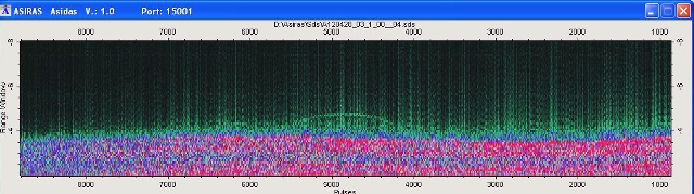
Radar response to corner reflector
After this flight we packed our gear and headed towards Station Nord. On route from Longyearbyen to Greenland we were able to survey Kongsvegen glacier, and the sea ice in the Fram strait.
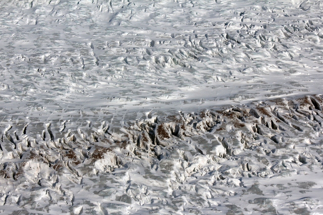
Konsvegen Glacier (H. Skourup)
As our survey altitude is about 300 m, from time to time we get a glimpse of the Arctic fauna from above. This time we were lucky to see group of whales in a pond of open water in the ice pack. Unfortunately we do not have any pictures, as even whales are only a few pixels wide in images taken from this altitude.
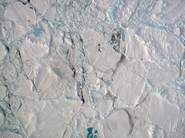
Sea ice
We landed at Station Nord at 14:08 UTC. Fortunately, the personal at the station were willing to support another flight, as this was the only chance to have an underflight of CryoSat over the sea ice north of Greenland. We only had time for a quick lunch, as we had to take off again at 15:40 because we wanted to rendezvous with CryoSat at 16:40 on a flight line about an hour from the station. We succeeded in surveying the line between 16:00 and 18:00 UTC where we ‘met’ CryoSat at 82N 52.6 15W 29.2 at 16:40:20, see photo of navigation screen.
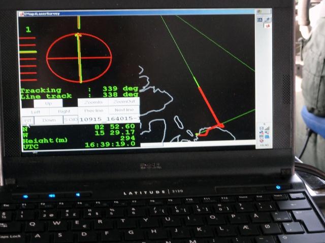
Navigation screen
Another successful day. The next main task will be the flight over Devon Island, we’re crossing our fingers for nice weather!
Discussion: no comments