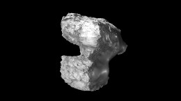
This week’s CometWatch entry is an image of Comet 67P/Churyumov-Gerasimenko taken with Rosetta’s NAVCAM on 2 June 2016, when the spacecraft was 23.6 km from the comet centre.
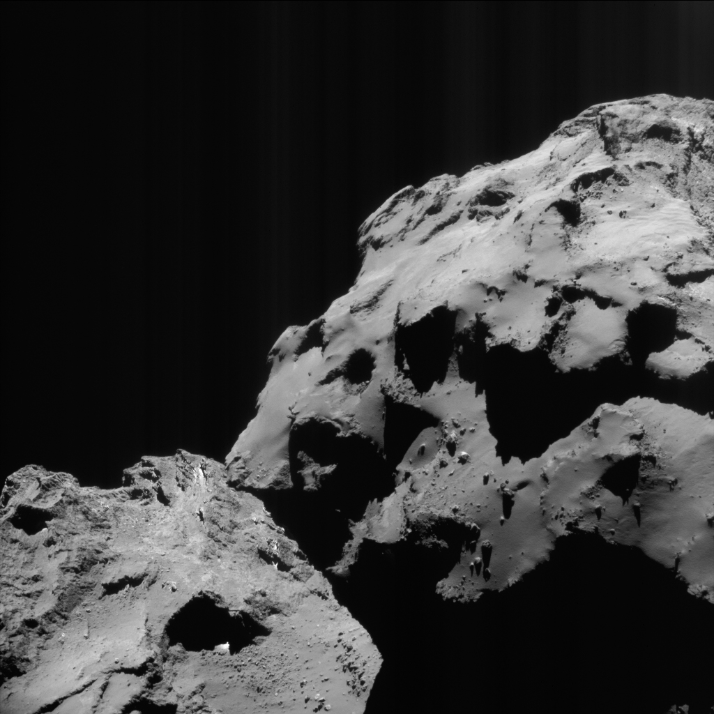
Enhanced NAVCAM image of Comet 67P/C-G taken on 2 June 2016, 23.6 km from the nucleus. The scale is 2.0 m/pixel and the image measures 2.1 km across. The faint vertical striping effect, especially visible in the top right corner of this view, is an image artifact. Credits: ESA/Rosetta/NAVCAM – CC BY-SA IGO 3.0
In this orientation, the small comet lobe is in the right half of the image, while the large lobe is in the lower left.
The smooth-covered terrains visible on the small lobe are part of Ma’at, a region blanketed in dust and punctuated with several boulders, especially towards the lower edge in this view. Below the boulders is the scarp that separates Ma’at from Anuket, a rougher region, cast in shadow in this image, which declines steeply towards the comet neck.
In the lower part of the image, on the neck region of Hapi, streaks of boulders stand out against a smooth cover of dust. Towards the left, parts of the Babi region can be seen, degrading smoothly into the terrains of Seth, in the lower left corner.
A few days later, on 6 June, Rosetta’s OSIRIS narrow-angle camera captured a striking view of a different portion of the large comet lobe, showing the boundary between Imhotep, in the top half, and Ash, in the lower half.
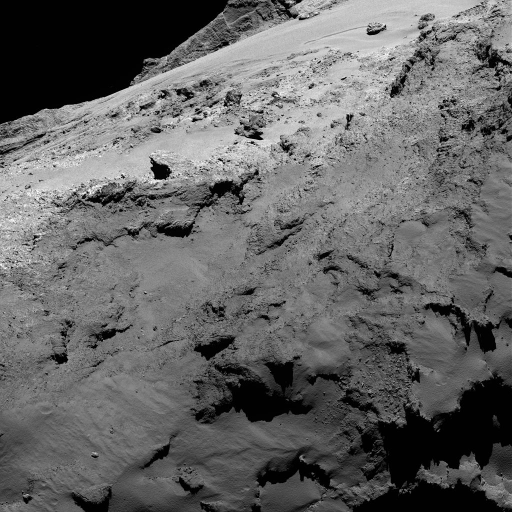
OSIRIS narrow-angle camera image taken on 6 June 2016, when Rosetta was 22.9 km from Comet 67P/C-G. The scale is 0.40 m/pixel and the image measures about 820 m. Credits: ESA/Rosetta/MPS for OSIRIS Team MPS/UPD/LAM/IAA/SSO/INTA/UPM/DASP/IDA
The image (above) shows the variety of smooth and rocky terrains found on Imhotep, as well as the 45-m boulder Cheops and two neighbouring large boulders towards the top right. The complexity of Imhotep contrasts nicely with the dust-covered portions of Ash, in the lower part of the image.
Another OSIRIS narrow-angle camera image, taken on 7 June about 64 km from the nucleus, portrays one more patch of the large lobe of Comet 67P/C-G.
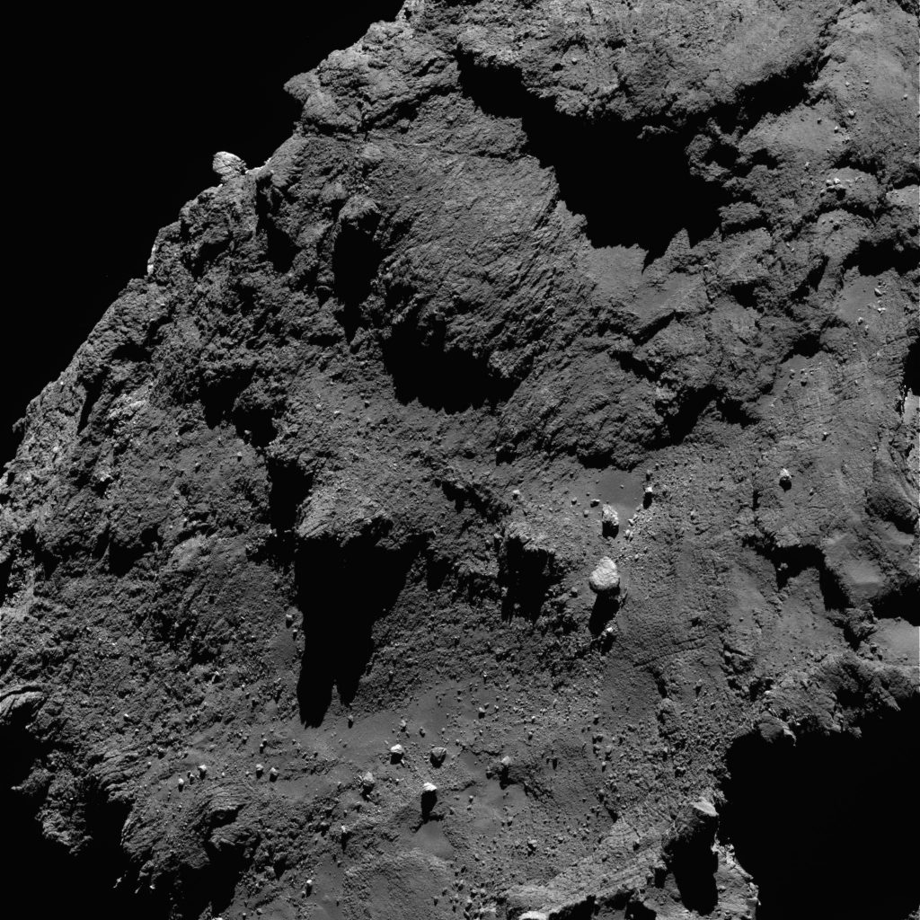
OSIRIS narrow-angle camera image taken on 7 June 2016, when Rosetta was 64.2 km from Comet 67P/C-G. The scale is 1.16 m/pixel and the image measures about 2.4 km. Credits: ESA/Rosetta/MPS for OSIRIS Team MPS/UPD/LAM/IAA/SSO/INTA/UPM/DASP/IDA
Along the top-right-to-bottom-left diagonal, the image (above) shows the complex terrains of Atum, characterised by numerous depressions and linear features; in the lower part of the image, a small portion of the Anubis region is visible, housing with many boulders, and transitioning towards Ash in the lower right corner.
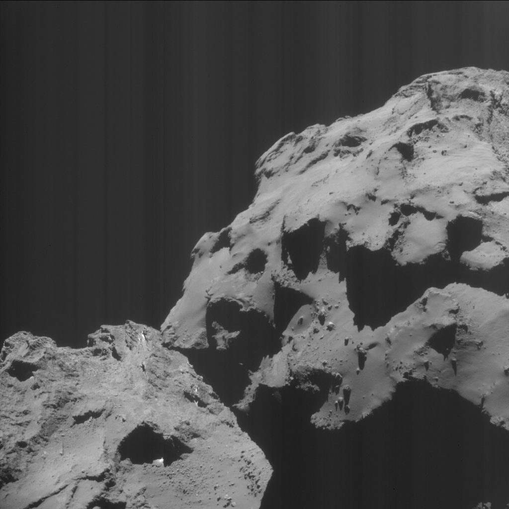
The original NAVCAM image is provided below.


Discussion: 9 comments
Gate at top-left of the frame are just the apex of two big rectilinear fails [facets?].
https://www.esa.int/spaceinimages/Images/2016/06/Comet_on_7_June_2016_OSIRIS_narrow-angle_camera
Good question, whether it’s really faults.
https://en.wikipedia.org/wiki/Fault_(geology)
Another option would be joints:
https://en.wikipedia.org/wiki/Joint_(geology)
The left side of the “gate” looks similar to a boulder in the sense of a clast which is more resistant to physical weathering than the surrounding matrix.
https://en.wikipedia.org/wiki/Clastic_rock
Logan and Gerald
Here are two views from ‘below’ of the same rectilinear fail.
https://imagearchives.esac.esa.int/picture.php?/8402/category/65
https://imagearchives.esac.esa.int/picture.php?/8210/category/65
I’ve annotated both the above linked photos as well as the one you refer to in this Rosetta post (3rd photo down) along with a whole bunch more. The link is here (scroll to A. Corradini gate rift):
https://scute1133site.wordpress.com/photos-for-off-site-comments/
The different colours are landmarks which act as fiduciary points so as to prove that the fail I’ve identified is the same one as yours. It’s the bottom large red dot in both the above photos and the top large red dot in the annotated version of this photo you’re discussing. After that, the other photos should be clear because the same colours are used for the same features.
As you can see, your rectilinear fail bears a striking resemblance to the A. Corradini gate which is also marked with a large red dot. I have already established that the A. Corradini gate is a rift. This is according to stretch theory which, as you both know, isn’t accepted by the Rosetta scientists. One can see that the gate is a rift by looking at the arrangement of the ‘craters’ round the corner on Seth. They too have rifted in at least four places (and have also caused the other two gaps along the sharply turning border between Seth and Anubis). The A. Corradini gate is the torn-apart wall of one of the craters that rifted.
Your rectilinear fail lies at the end of a valley. The two sides of the valley curve round from your fail towards the two boulders (dotted blue). If you produce the lines of the two valley sides further, they reach to the A. Corradini gate. One kisses one side of the gate and the other line kisses the other side. Although I am saying “if you produce…” as in drawing imaginary lines, there are photos that show actual lines here, joining the obvious section of valley to the A. Corradini gate.
If yours is a rectilinear fail, then the A. Corradini gate most certainly is too. Yours is almost the same in shape and somewhat smaller in size. It also has a neighbouring dip to take up the rest of the valley.
I would say therefore, that these two strikingly similar rectilinear fails are rifts. They lie at either end of the rift between two delaminating layers.
The last photo of the bunch puts the two rifts (A. Corradini gate and logan’s rectilinear fail) in perspective as two rifts among a veritable sea of rifts, all going in the same direction.
Cooper, after seeing yours dots can’t go back to see that place the same way, ever. 🙂
Thanks, Gerald and Cooper. Going for the joints. Just as at our wood furniture. Stress tend to deliver actual work there, so the clasting. Of course, wood stress use to be more humidity wave related.
Should We consider humidity waves also, as relevant to 67P stressing?
[‘another’ necking factor speculation]
That dust brought back by coma return doesn’t deposit following gravity lines. It deposit West impacting. On the progressive winter cooling it gains weight from ‘seeding’ sublimates from orbital heat inertia. That accumulating weight causing the ‘flowing prairies”.
Flowing West Praires 😀
https://www.esa.int/spaceinimages/Images/2016/06/Comet_on_2_June_2016_NavCam
Coma return dust falling East>West. Praires flowing West>East.
[Speculative wander].
‘Pasta’ also explained. Broken over cliffs semi-sintered prairies.