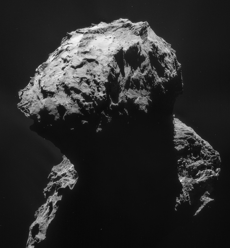
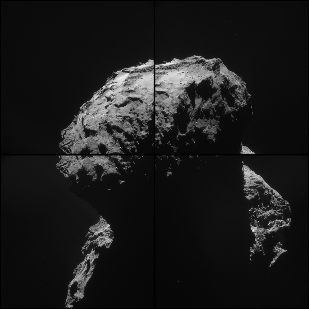
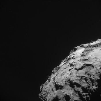
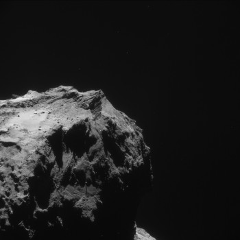
Today’s CometWatch mosaic comprises images taken by Rosetta’s navigation camera (NAVCAM) on 18 January, from a distance of 28.4 km from the centre of Comet 67P/Churyumov-Gerasimenko. The image resolution is 2.4 m/pixel and the individual 1024 x 1024 frames measure 2.5 km across. The mosaic is slightly cropped and measures 3.7 x 4.0 km.
Four image mosaic comprising images taken on 18 January 2015 by Rosetta’s Navigation Camera (NAVCAM). Rotation and translation of the comet during the imaging sequence make it difficult to create an accurate mosaic, and there may be some spurious spatial and intensity features as a result of the mosaic-making sequence, so always refer to the individual frames before performing any detailed comparison or drawing conclusions about any strange structures or low intensity extended emission. Credits: ESA/Rosetta/NAVCAM – CC BY-SA IGO 3.0
The mosaic focuses on the smaller of the comet’s two lobes, with the shallow, 1 km wide depression we now know to be called Hatmehit situated towards the top. Bordering Hatmehit are the Ma’at, Maftet and Bastet regions (refer to the maps here and here to get oriented with Comet 67P/C-G’s geography).
The flanks of the comet’s larger lobe can be seen in the background of this mosaic, while much of the foreground is dominated by shadow.
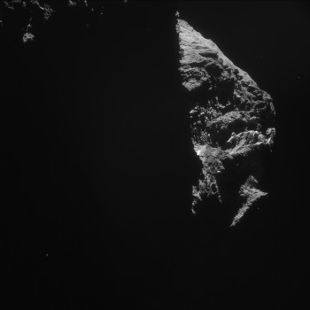
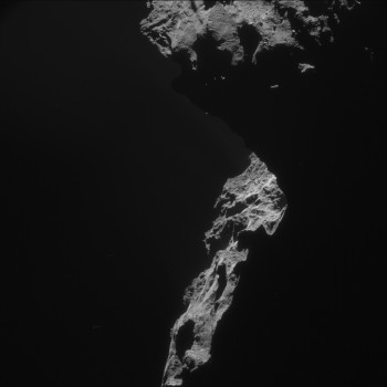
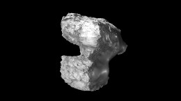
The four individual 1024 x 1024 frames, along with a montage of the frames, are provided below:



Discussion: 21 comments
Sleep tight, Philae. If it’s not yet a time to wake up.
Oops– your links seem to be missing for the “raw” A-B-C-D” images– all we get are the 350×350 thumbnails, and also the “montage” image. the Mosaic img come thru fine…
Ah, Mondays… 🙂
–Bill
Ooops! Thanks for pointing it out – links now working! 🙂
It has occurred to me that the ‘hourglass’ shape may be more the rule than the exception in these comets that are touched by the Sun. This is from the cometwatch images, particularly the recent one that was enhanced to show the streams of material starting to emerge.
Here’s a thought experiment to illustrate my hypothesis:
Suppose we start with a spherical body, composed of frozen materials that we earthlings would consider volatile, such as CH4, CO2, H2O, etc. It is rotating about some axis, and it is in an eccentric orbit which carries it toward the Sun.
As it gets close enough to the Sun that the volatiles can mobilize, say 100°K or so, its equator warms up faster than its poles.
Over time, now, the equatorial region begins to lose material to sublimation, and it develops canyons and craters and begins to subside. These depressions concentrate the solar heat — like the Grand Canyon, where it is much hotter at the bottom than it is up at the top.
Eventually, the equatorial canyon becomes a neck, like we are seeing here. When the neck can no longer support the weight of the hemispheres, it breaks. The broken pieces will fall together, probably trapping some voids, as there is not enough gravity to close them.
Finally, the collapsed object, with a new rotation axis as a result of the shifted collapsed hemispheres, begins to lose material around its equator on successive perihelion passes. It develops an equatorial canyon system…
Another great image Emily, thanks. The change of season is now becoming apparent. Previous images of this area have shown very little of the comet illuminated below the rim of Hatmehit. A large area is now illuminated along with a lot more of the “dark side” of the body lobe. As noted before, the dark side is almost devoid of the surface “dust” blanket.
I have drawn a rough ellipse over the CONSERT search area on this cropped and slightly zoomed image below. Unfortunately despite all the newly illuminated parts of the comet we can see, the resting place of little Philae remains stubbornly hidden in the shadows. Annoyingly the crevice she is likely to be hidden in is just inside the edge of the shadow running down the centre of the circle. Half an hour later in the comet day she might have been visible. If the image had been taken today at the same point and time the crevice may well be illuminated too. However I gather that Rosetta is changing her orbit soon in preparation for the Valentines Day close fly-by so another image from this viewpoint may not be possible again. I think we can see though that it will not be long before Philae starts to see more sunlight earlier in the day.
https://www.flickr.com/photos/124013840@N06/16373930901/in/photostream/#
Hang on little Philae, Spring is coming.
Hello Robin, I have the feeling most people, including you, forget the effect of the relative movement of Rosetta during the taking of the photos of the positions of Philae descending and bouncing. In fact Philae was descending nearly vertical relative to the comet head, but it was shown as a trajectory because of Rosetta flying over while taking the pictures. So you have to subtract that movement.
To be more precise: the descending Philea seems to follow the red path at left in this reconstruction of you (https://www.flickr.com/photos/124013840@N06/15985932392/in/photostream). But in reality it went vertically down. So the blue line must be incorrect as well. In fact the blue line should go much more down and not to the right if you correct for the movement of Rosetta.
Paul, You are right about Philae’s descent path. This image was produced long before data was available to track Rosetta’s movement and as I note in my description, these are not calculated trajectories or even particularly accurate, they are just to give a rough idea of Philae’s journey and how the two bounces might look relative to the comet.
This video was released yesterday on You Tube and is a talk given at the SETI Institute the week of the AGU meeting in December. Towards the end are the lander team calculated trajectories, with heights and speeds covering Philae’s journey along with a couple of illustrations. Other than Philae’s descent path and the height of the bounces the paths are similar.
https://www.youtube.com/watch?v=tQLtAp1Aw48
I would actually put the correct area further up on the image. It is hard to make out any details in the images we have unfortunately. Just the same it seems to be a pretty rough area from the images we do have and obviously mostly in the shadows. My reading of the latest CONSERT search area that I’ve seen would put it somewhere around this area:
https://i.imgur.com/wy5La6W.png
Credits: ESA/Rosetta/NAVCAM – CC BY-SA IGO 3.0
Agreed Daniel, the shape model on which the most recent CONSERT search area is drawn, is lacking in detail of this, until very recently, entirely shadowed area. Any attempt to place and scale it exactly is difficult, so I deliberately used a bigger “approximate” area. I can’t argue with your placement though. The NAVCAM images from the 21st and 25th of November seem to give the best view of this area. Philae seems to have found the most difficult place on the comet for Rosetta to get an illuminated view from it’s terminator orbital path. No wonder Philae only originally got an hour or so of sunlight.
The radio communications data does suggest a position where Philae points almost vertically to the “sky”, so at least she is not hidden under one of the commonly seen overhangs, just surrounded on three sides by crevice walls, with the floor of the alcove opening, dropping away below Philae. If you really push the contrast of the CIVAS panorama shot of the sky, a slither of cometary material can be seen at the bottom of the image and the start of the side wall in the lefthand corner. Either the two front feet are impaled by the ice screws on boulders, or outcrops from the alcove walls, or as the alcove narrows they have become wedged against the walls on either side. The back foot seems to be buried in the floor at the back of the alcove at a point higher up the sloping floor, the downward slope running from back to front. This would give the clearance beneath Philae seen in the ROLIS images and might explain why the SD2 drill did not reach the surface.
So we are looking for a crevice only a metre or two wide, with the wall extending only on Philae’s right side and with an entrance at about 11 O’Clock which drops away quite rapidly. Unfortunately images of other areas of the comet show this is quite a common formation and hidden in those shadows maybe more than one, but the NAVCAM images mentioned above do show one which can be shown to match the CIVAS panorama view in front of Philae and to Philae’s left has an alcove wall which is strikingly similar to the “Perihelion” cliff in the CIVAS image. Outcrops and formations on the extended righthand wall can be matched to those seen in the front right and right side CIVAS images.
Yes I could be wrong, but what evidence is there for a better candidate, or to rule out my suggestion? Direct imaging of Philae would now seem to be unlikely, unless the decision is taken to route the upcoming close fly-by such that a close up image of this area in favourable lighting conditions can be obtained. Are the mission planners going to compromise large amounts of planned science observations and the future mission profile for information that, a) they might not get, given the nature of the terrain, or b) may be provided by Philae later in the year if or when she re-emerges from hibernation, or c) is already available to at least define an interim position, in case definitive evidence does not become available until close bound orbits are possible again in 2016?
Agreed, it was somewhat difficult to determine exactly where the CONSERT area was using the less precise determination they had. I had actually thought Philae would end up being in the area you circled as well at that time.
Changing the flyby is definitely a difficult decision. As you said, Philae might wake up again and give the information needed herself. But there is of course the scientific benefit of putting the Philae results into context by knowing where it landed (especially for CONSERT) and getting a more detailed view of its surroundings. If they are very unlucky you could imagine the comet crumbling where Philae is during its perihelion passage, making that impossible in 2016.
I wonder if there are any good (i.e. well lit) OSIRIS images from the close October orbit. Obviously Philae wasn’t there then, but perhaps they would contain enough details to make a good guess as to where Philae could be.
As for the images we do have, the November image is quite good as you said (https://blogs.esa.int/rosetta/2014/11/24/cometwatch-20-november/) but I also quite like https://blogs.esa.int/rosetta/2014/11/07/cometwatch-4-november/. Not because you can actually see anything of the CONSERT area itself as it is fully shadowed, but because you can see the seemingly jagged contours of the “hill” where it is.
Wonderful Emily.
Looks like the Sun is starting to shine on the top of the back of the ‘head’ as the seasons slowly change on the comet .
Andrew R Brown.
There is a bright feature near the center of image D, just next to the terminator. What do you think it is? A patch of exposed ice or just a piece of rock oriented toward the Sun?
It can be seen in the D frame from the NAVCAM image in https://blogs.esa.int/rosetta/2014/12/09/cometwatch-7-december/. You can also see it (although then almost from above) in some of the D frames from the movie montage.. It does seem to be a real feature I would be surprised if it turned out to be simply a cliff face that has the same albedo as its surroundings.
It is perhaps a bit risky to take too much from the images we have of the area thus far, but it seems like there is a boulder precariously balanced on the top of one of the ridges as well.
The “boulder” is at the orange arrow, the cliff face with the white patch at the blue arrow and finally the green arrow is simply there to provide an additional fix-point.
https://i.imgur.com/pILDMQb.png
Credits: ESA/Rosetta/NAVCAM – CC BY-SA IGO 3.0
NAVCAM images from left to right in the order 22nd November 2014, 7th December 2014 and 18th January 2015.
@ Daniel
Many thanks for the images and the crystal-clear explanations.
I’ve also noticed that in the left-hand image of https://i.imgur.com/pILDMQb.png, there is, slightly to the left of your orange arrow on the other side of a dividing crevasse, what appears to be a “nest” of 6 or 7 white “eggs” (they look like fairly round boulders). Interestingly, in the right-hand image, there seem to be fewer of them or perhaps some of them are simply less “white”.
Do you know what the time-lapse was between these two images?
The leftmost image was taken on 22nd November 2014, the rightmost image on was the one in this blog post, i.e. 18 January 2015.
I believe the change you see is purely due to two things. First of the different camera angles means the reflecting surface are is reduced, being squished together due to the angle and hiding some of it. The second being the additional shadows around the “nest” in the leftmost image. In the rightmost image the surroundings are lighter, making the seem “nest” darker in comparison. The first affect (angle) being the dominant change then.
As an aside, the shadows in these images contain quite a lot of information that you can bring forward by changing brightness levels, due to the light reflecting from the cliff faces into the crevasse below. But not much more than what could already be seen in https://blogs.esa.int/rosetta/2014/11/06/into-the-shadows-of-comet-67pc-g/.
Thanks for the information and explanation!
@Jim Robertson:
“It has occurred to me that the ‘hourglass’ shape may be more the rule than the exception…”
It might be that “contact binaries” are common. Or it might be that major compositional differences in the accreted components are as common. We’ve seen chondrules in meteorites. We see “goosebumps” at OSIRIS-scaled images. We see structural differences in the several large boulders that have been imaged. Looking at the body of the comet there are clearly structural and compositional differences between the various geomorphic terrains. It’s all a matter of scale. We are looking at differences in a primally-accreted body, as well as differences in how that body sublimates or erodes over time.
And this is not even considering the “metamorphic” effects of sublimation, mobilization and redeposition (“refreezing”) of volatiles within the comet or on surface cold traps during the perihelion passages.
Comets are well-reputed to have sudden and unexpected “flare ups” which are likely due to slumps, structural failures and general settling. We’ll stay tuned… 🙂
–Bill
“Comets are well-reputed to have sudden and unexpected “flare ups” which are likely due to slumps, structural failures and general settling. We’ll stay tuned..”
The comet Holmes “flare-up” (among many others, including Rosetta’s own unexpected “flare-up” back in last April) remains unexplained and inexplicable by standard model mechanisms.
Bill,
Thanks for the response.
Yes, there are several likely mechanisms leading to a “rubber ducky” shape. This is the most fascinating mission yet, to explore the Solar System. Up close and touching, tasting, a thing which at the same time preserves (perhaps) a remnant of the cloud that came before the Solar System, and a dynamic body itself.
Most of the usual ‘smoothing’ forces we encounter here on Earth do not apply. Almost no gravity, no liquid state (so no surface tension), and a decidedly non-homogeneous composition of volatiles and refractories.
In some of the enhanced images, I can sort of see how the streamers get ‘collimated’ by subliming off a concave surface (the basis of my suggestion above). And those concave surfaces also concentrate the solar heat by merely being concave. And, your point about refreezing is a good one, too. The opposite of a concave, solar-absorbing surface would be a shaded, convex surface, which would efficiently radiate heat and serve as a collection area for the volatiles.
When I first saw the Philae images, I was struck by the extreme ‘jaggedness’ of the features around it.
I’m eagerly looking forward to more of the science from this mission.
These images are inspiring!!
Thank you!!!
Still no idea how Hat me hit has formed? Apart from stretch theory?