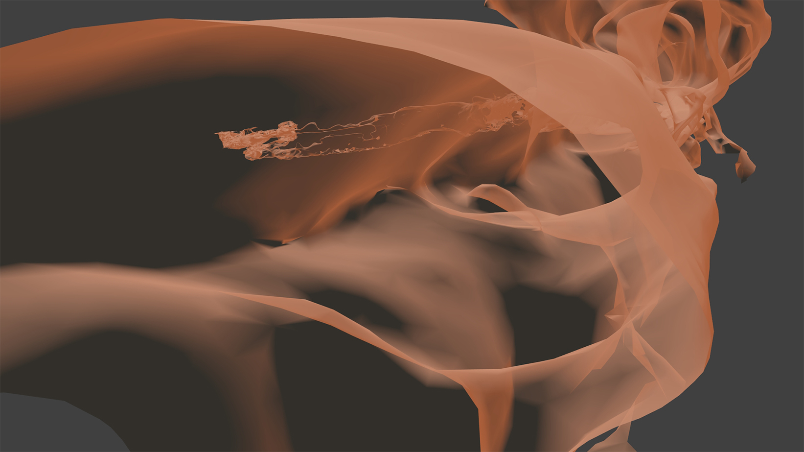
Volcanic wormhole. Copyright: Vigea – Tommaso Santagata
As a child, Tommaso Santagata would have never imagined that he would test some of the newest and most innovative 3D-scanning technologies for future space exploration. Last year, he spent five days of intense mapping in Lanzarote, Spain, during the Pangaea-X campaign. While the first results from that pioneering course keep flowing in, the adventurous speleologist has produced the largest 3D scan of a lava tube on Earth.
Along with his colleagues Umberto Del Vecchio and Marta Lazzaroni, he mapped most of the lava tube system as part of a project supported by the Cabildo of Lanzarote and the University of Padova, Italy. The resulting map comes alive in great detail, helping local institutions to protect this subterranean environment. It also provides scientific data to study the origins of the tube and its peculiar formations.
The terrain
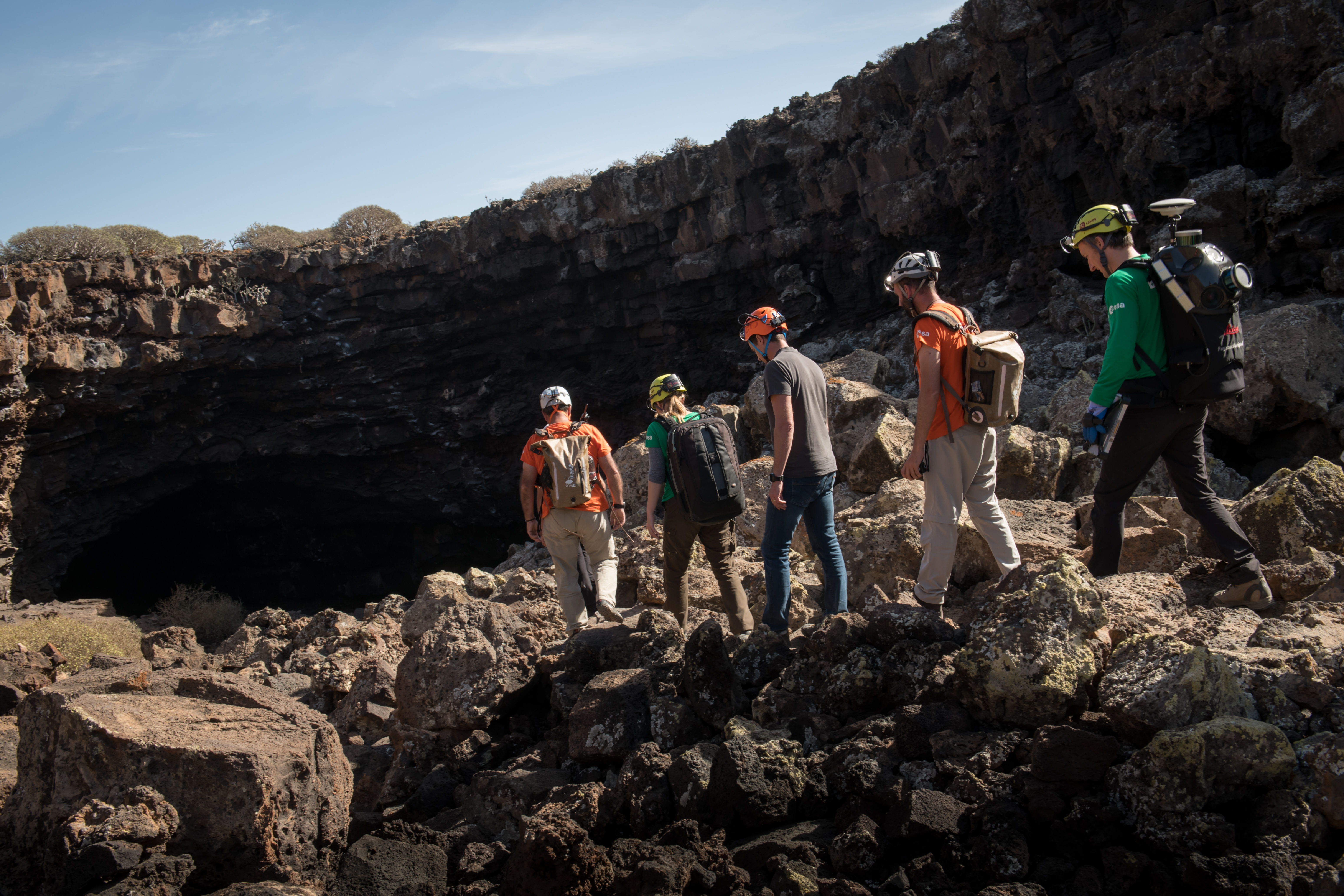
The Pangaea-X expedition ventured into the “La Cueva de los Verdes” lava tube in Lanzarote, one of the world’s largest volcanic cave complexes with a total length of about 8 km. The cave has both dry and water-filled sections.
The six-kilometre dry portion of the lava tube has natural open skylights, or jameos as the locals call them, that are aligned along the cave pathway. Some of the caves are large enough to accommodate residential streets and houses.
These formations are very similar to those found on Mars and on the Moon. Being underground structures, they offer good shelters from radiation. This similarity makes Lanzarote a great environment to train astronauts and simulate space exploration.
Why 3D mapping inside a cave?
Mapping expedition. Copyright: ESA–Robbie Shone
When a new environment is discovered, mapping the area is always a first starting point of exploration. This also applies to missions to other planets, where one of the main objectives will be to choose places to setup base camp.
Lava tubes are environments with a constant temperature, shielded from cosmic radiation and protected from micrometeorites, and so could providing safe habitats for humans.
Precisely measuring the geometry of lava caves will allow scientists to improve their models and better understand their evolution on other celestial bodies.
For these reasons, learning how to map lava tubes on Earth is helping exploration off Earth. ESA astronaut Matthias Maurer joined the expedition to test two different instruments developed by Leica Geosystems.
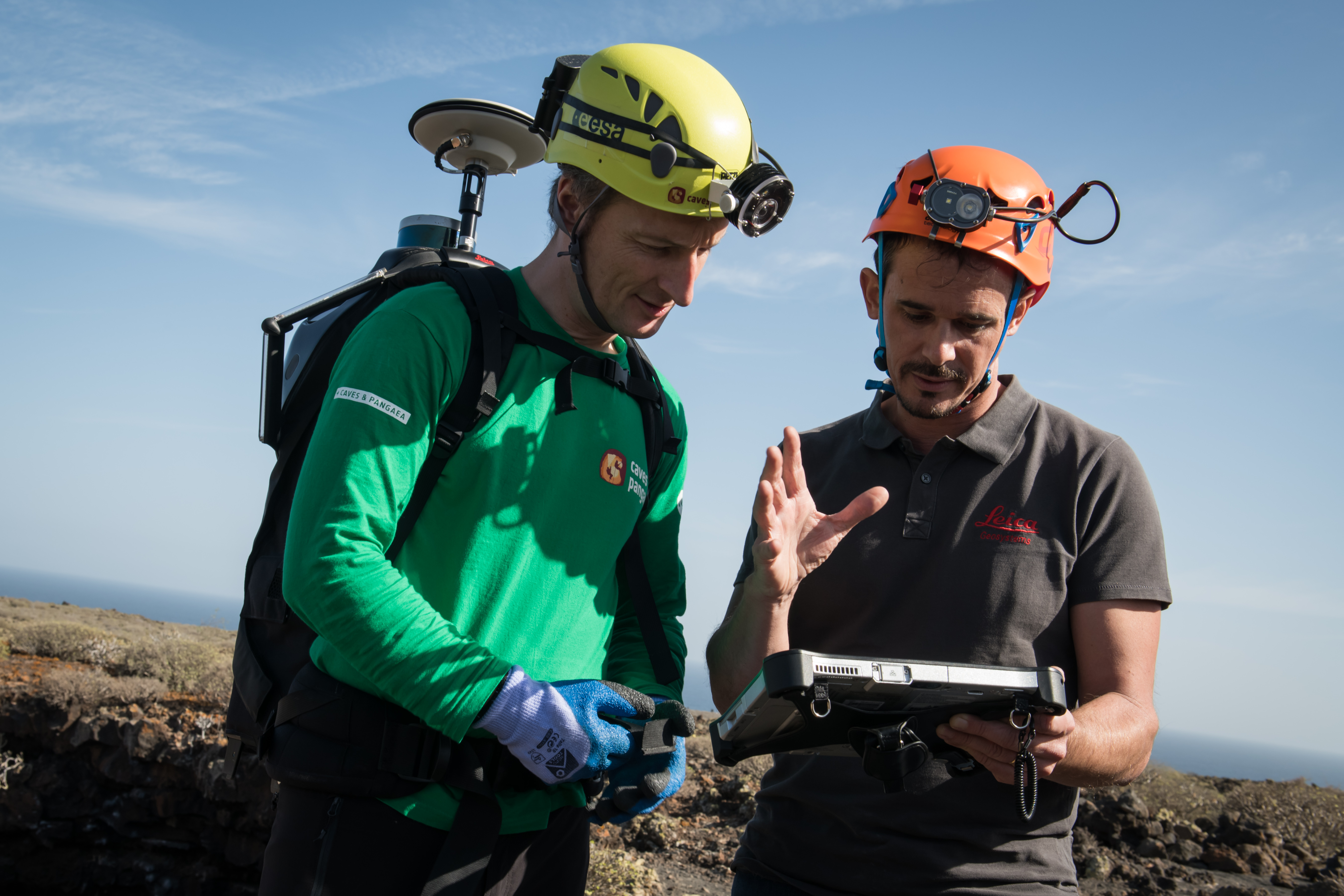
Equipped for 3D mapping. Copyright: ESA–Robbie Shone
Mobile mapping
The Pegasus Backpack is a wearable mapping solution that collects geometric data even without a satellite signal. Matthias learned from the principal investigator Raphael Goudard how to operate the equipment in just 20 minutes.
The astronaut walked through the difficult terrain and checked the results on the spot through a tablet. He performed his cave-mapping mission by walking along the tube and back to compare the accuracy of the data.
“Hiking and performing geological mapping with the high-tech backpack was easy and efficient. I can perfectly see it integrated in our spacesuits for future exploration missions to the Moon or Mars,” says Matthias.
This instrument synchronises images collected by five cameras and two 3D imaging LIDAR profilers, the laser equivalent of radar. It enables accurate mapping where satellite navigation is unavailable, such as in caves.
3D laser scanning
In Lanzarote, lava tubes generally develop along tunnels on different levels due to lava flowing over multiple eruptions and following cracks and crevasses left from previous eruptions. It is not always possible to access the upper levels without climbing equipment.
Last year, as part of the CAVES 2016 training course the team used photogrammetry – getting precise measurements and three-dimensional data from at least two photographs – as a good alternative. However, photogrammetry cannot always guarantee good results, especially without the right light conditions.

Testing inside the lava tube. Copyright: ESA – Alessio Romeo
To solve these problems the Pangaea-X campaign tested the Leica BLK360, the smallest and lightest imaging scanner on the market. Leica’s expert Farouk Kadded operated it in set positions, obtaining 360° images of the environment in just three minutes by pressing one button and aligning the scans directly through a tablet app.
In less than three hours, data from both instruments obtained a complete 3D model of a 1.3 km section of the lava tube.
This demonstrates the limitations of each technology but also the advantages of integrating them for better results.
Tommaso Santagata is a speleologist and expert in 3D cave mapping. He joined CAVES 2016 to teach photogrammetry techniques to cavenauts and to produce 3D underground animations
Discussion: 8 comments
Thanks for sharing this amazing information with us. Cheers
Amazing article with great information.
Thanks
Thanks for sharing this amazing post with us.
regards
Ram Chauhan
Great article and respect your work.
This article is really good and having good informations
I appreciated what we did here. I enjoyed every little bit some of it. I am always trying to find informative information this way. Thanks for sharing around.
Thank you so much for this post.
Thanks for sharing this amazing information with us.