


From Rene Forsberg (DTU-Space), Alert, 1 April
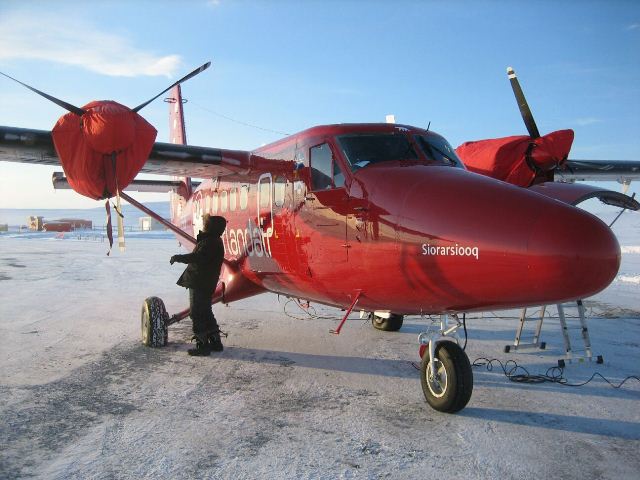
Twin-Otter aircraft at Alert, northern Canada
The ESA Norlandair Twin-Otter, which we are responsible for during the ESA CryoVEx campaign, is equipped with a CryoSat-like radar called ASIRAS and a laser scanner. Last Thursday, we flew over the Arctic sea-ice on a 5-hr mission starting from our Alert home base at the northern tip of Canada.
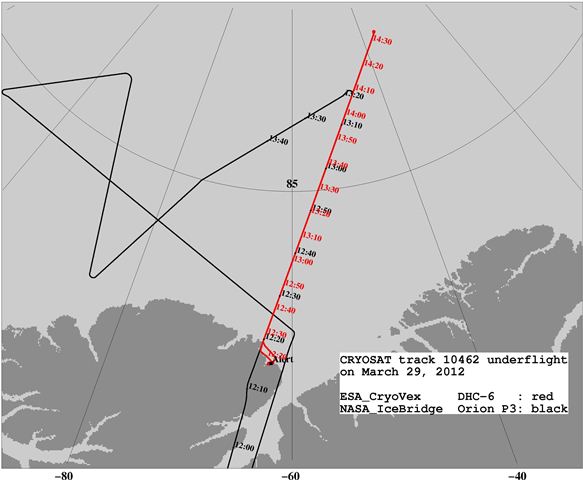
Flight tracks of the two aircraft, with times in decimal hours
By taking off quickly early in the crisp cold Arctic morning we reached the CryoSat track at about 8:25 local time, which is within two minutes of the overhead pass of CryoSat satellite more than 600 km above. That morning the NASA IceBridge P-3 aircraft also underflew the same track, six minutes ahead of our plane. As they fly much faster we could not catch up – but this was not our goal. We know that by combining radar, laser and optical data from both aircraft missions today we will gain both valuable information on sea-ice thickness and conditions below and a better understanding of how CryoSat measures ice thickness from space.
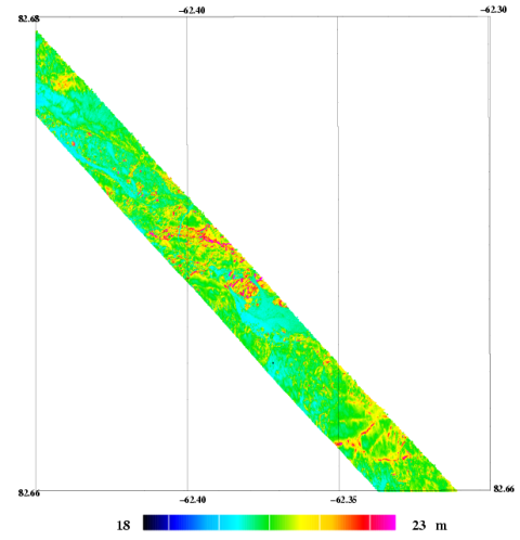
Example of quick-look data showing the height of the sea ice in the GPS coordinate system. Red colours are ridges, and blue areas thinner ice.
The joint experiment was a great success in cooperation and execution, with a nearly perfect alignment of aircraft and satellite, blessed with excellent weather (no clouds or wind, and a minimal sea-ice drift). The instruments on the ESA aircraft all functioned well, in spite of the low temperatures during the morning takeoff (–35°C). The cold has already provided some challenges during the flight to Alert across northern Greenland to the small (but resolute and able) DTU-Space team participating in CryoVEx 2012.
The figures above show some examples of the tracks of the two aircraft, with the NASA and ESA flights in red and black. The ESA aircraft repeated the measurements along the 500-km line flying out and back at two different elevations. By taking two looks at the same ice below we hope to be able to estimate sea-ice drift. An example image of ice freeboard (how far the ice extends above the water surface) as measured from our plane is also shown.
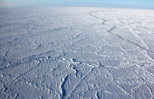
Arctic sea-ice
The photo of the sea ice taken from the plane that morning will give you an idea of what it looks like out there. The ice is several meters thick, but changing frequently to thinner leads (cracks between ice floes) and thicker ridges.
DTU-Space crew: Henriette Skourup,Arne Vestergaard Olesenand Rene Forsberg
Discussion: no comments