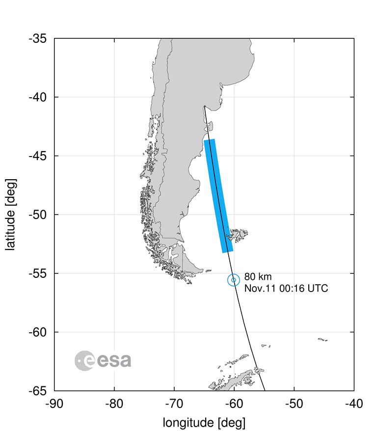
A very informative graphic provided by the ESA Space Debris Office showing the path taken by GOCE during its final destructive re-entry on 11 November 2013.
The graphic summarizes the GOCE impact location as reported by the USA’s JSpOC (JOint Space Operations Centre, at Vandenberg Airforce Base, California) at 56° S and 60° W, at 01:16 CET, Monday, 11 November, 2013, combined with the impact ground swath that was estimated by ESA’s space debris experts using the SCARAB (Spacecraft Atmospheric Re-Entry and Aerothermal Break-up) software tool.


Discussion: no comments