


Setting up a science station guided by Sentinel-3
Post from: Rudy Castorina (Ocean Media Lab) & Craig Donlon (ESA)
Out here in the North Atlantic, every decision matters. The waves, the wind, the instruments and the planning and the satellites above us all come into play when we set up a science station.
In this video, we take you behind the scenes of how our team of students, lecturers and onboard scientists prepare and execute a data collection station during the ESA Ocean Training Course 2025. From choosing the location to deploying instruments, it’s a process that blends precision, timing, and teamwork.
This specific station was designed to exploit an overpass from a key satellite mission – Sentinel-3, one of the ESA-developed missions in the Copernicus programme, which is the Earth observation component of the European Union’s space programme.
Using near-realtime data from the Ocean Virtual Laboratory, we synchronised our operations to collect in situ measurements such as chlorophyll concentration and temperature from the surface to the deeper ocean at 1200 m, together with estimates of the ocean-surface currents using drifters and acoustic doppler current profiler data.
This is all planned to take place at the exact time Sentinel-3 was passing overhead. Such coordination allows us to compare what we measure at sea to observations we collect from the ocean and land colour imager (OLCI), sea and land surface temperature radiometer (SLSTR) and radar altimeter (SRAL) instruments aboard Sentinel-3A and Sentinel-3B satellites.
Through this process, called validation, we are checking the performance of the satellite’s instruments and the algorithms applied to the data to retrieve geophysical parameters from space with in-situ observations.
It’s a powerful exercise for students: learning not only how to collect oceanographic data, but also how to interpret satellite images and understand the science behind Earth observation.
In upcoming posts, we’ll explore more about how ESA satellite missions like Sentinel-3 inform our course and expand the students’ ability to cross-reference remote sensing data with field measurements.
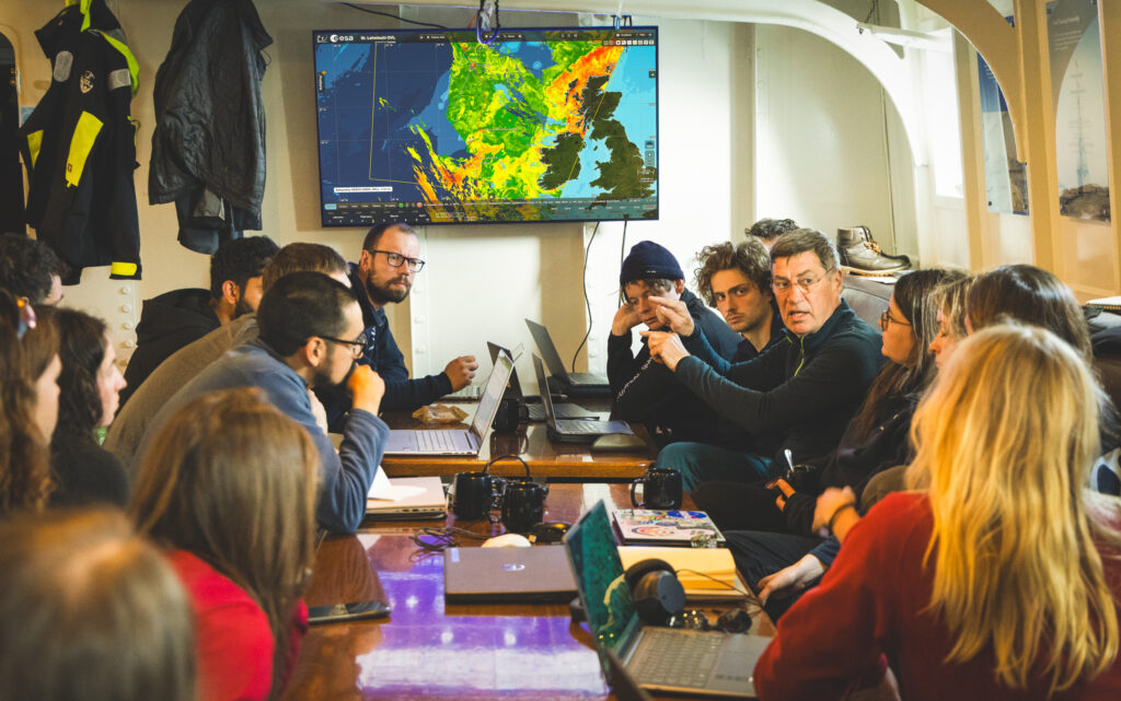
Florian Le Guilou, former ESA research fellow, Artem Moiseev from the Nansen Center, and Roger Haagmans former GOCE and Swarm mission scientist at ESA, mentoring students on station planning. (ESA/Ocean Media Lab)
Because here, Earth observation ocean science is at the core of everything we do. We are investing in our future by training the next generation of ocean science ambassadors working with Earth observation data – out on the ocean together.
Discussion: no comments