Most of the data that we collect on AMT4SentinelFRM are water profiles or continuous surface water measurements. However, every day at midday we also collect atmospheric data when Werenfrid Wimmer from the University of Southampton launches a weather balloon aft of the Conductivity, Temperature and Density CTD winch gantry.
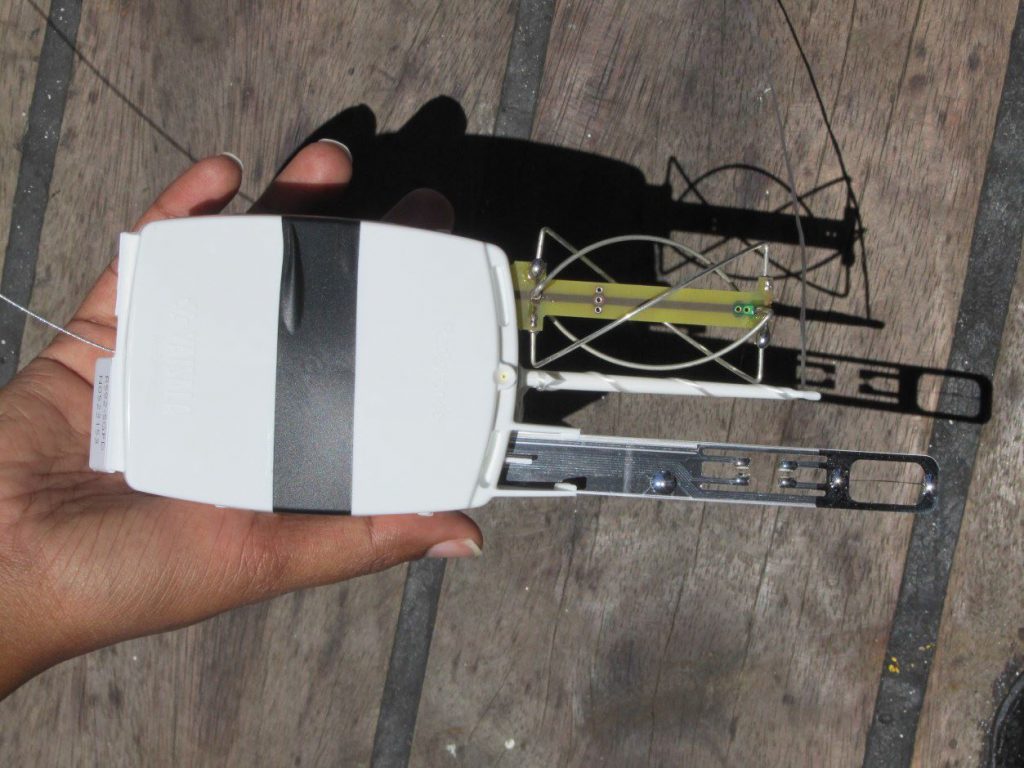
These balloons carry a device, which is about the size of your hand, through the lower atmosphere. It collects atmospheric temperature, humidity, pressure, wind speed, wind direction and geographic position data as it ascends to about 30 km above the ship and travels up to 50 km away from it.

A radiosonde, about the size of your hand, is launched during the ATM4SentinelFRM campaign each day to collect atmospheric data. (PML)
The device carried by the balloon is known as a radiosonde and is powered by batteries (6 AA Alkaline) that transmit the data by radio to a ground receiver at a frequency of 403 MHz.
On land, hundreds of radiosondes are launched everyday all over the world, and the data forms an essential component of numerical weather prediction. There are very few of these launches over the open ocean, so the data that Werenfrid collects on this year’s AMT4SentinelFRM campaign is not only very rare, but is essential to help to model and correct for atmospheric effects in satellite data over the open ocean.

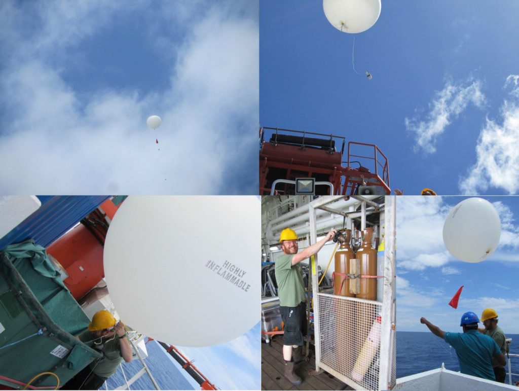
Launching a weather balloon. The balloons are filled with high grade Helium dispensed from bottles stored below deck. (PML–Rebecca May)
The balloons that lift the radiosondes through the lower atmosphere are made of latex and are filled with helium. The balloon ascent is determined by the thickness and diameter of the balloon, and grade and purity of the helium. On AMT4SentinelFRM we use 350 g balloons and the maximum height reached so far on this campaign over the Atlantic has been 29770 m.
We will use five 50 litre bottles of grade A Helium for approximately 42 launches during this year’s campaign.

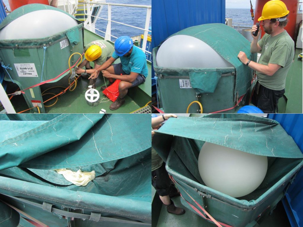
Top left: radiosonde and parachute (red) attached to base of balloon; top right: Werenfrid Wimmer checks to see if it is safe to launch; bottom left: balloons are made of latex; bottom right: balloons are inflated in a pod. ((PML–Rebecca May)
As the balloon travels upwards through the lower atmosphere, the pressure decreases, which causes the balloon to expand and eventually burst after which a small parachute carries it back down to the sea surface. The data are transmitted by radio to a computer, where the data is stored and can be downloaded.
Globally, there are approximately 1300 radiosonde launch sites and launches are coordinated at the same time every day (00:00 UTC and 12:00 UTC).
This effort provides a worldwide perspective of atmospheric conditions and is used to improve and refine numerical models for weather forecasting. There are very few sites over remote ocean locations, especially in the Southern Ocean.
AMT4SetinelFRM and Werenfrid’s work contribute to filling in these gaps.

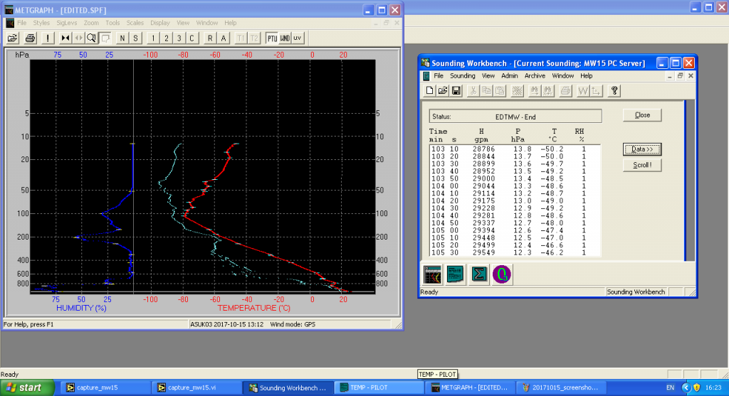
Example temperature, humidity and dew point profiles from radiosonde launch at 10 29.170 degrees S, 25 03.482 degrees W in the Atlantic Ocean, Sunday 15 October at 13:20 UTC. (PML)
Post from: Gavin Tilstone (Plymouth Marine Laboratory) and Werenfrid Wimmer (University of Southhampton)


Discussion: no comments