


The EarthCARE satellite, ESA and JAXA’s Earth Cloud Aerosol and Radiation Explorer, has been in space for more than 500 days and over 8000 orbits. One of the four instruments on our most complex Earth Explorer yet is the atmospheric lidar, ATLID. This instrument fires pulses of UV light towards Earth, revealing features such as cloud tops and aerosols in the atmosphere based on the light that is scattered back to EarthCARE.
ATLID has shed light on many features, including polar stratospheric clouds, Canadian wildfire smoke, mid-latitude cyclones, gravity wave-enhanced Antarctic ice clouds, and even ocean phytoplankton.
This would not be possible without a global effort to ensure ATLID data are as accurate as possible, and EarthCARE has overseen an incredible set of calibration and validation campaigns in support of the mission. One such intrepid campaign was NightBLUE, which took to Bermuda’s skies in a Caribbean storm season that later saw one of the strongest hurricanes on record.
NightBLUE – a collaboration involving ESA, NASA and the EarthCARE Data, Innovation and Science Cluster – achieved a huge milestone: the 100th underflight of EarthCARE.
Diko Hemminga of the Royal Netherlands Meteorological Institute (KNMI) takes us through what it’s like to fly on such a campaign.
Introducing NightBLUE
The lidar underflights of EarthCARE took place from Bermuda in the North Atlantic Ocean in September 2025. Most flights took place at night, when the signal-to-noise ratio is best for lidar instruments. Our mission, as part of ongoing validation efforts, was to put the data products on processing baseline BA to the test – the basis for the recently released first reprocessing of the full mission so far.
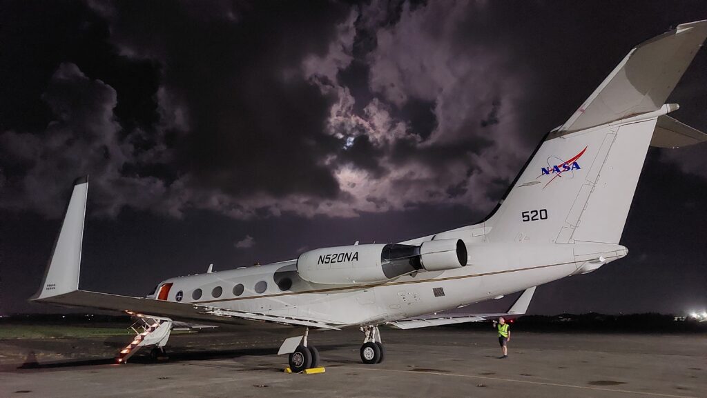
The NASA G-III aircraft at night. (Credit: Diko Hemminga / KNMI).
During the NightBLUE aircraft validation campaign, an ideal comparison setup for ATLID featured the NASA HSRL-2 instrument onboard the NASA G-III aircraft, which measures the atmosphere and near-surface ocean just like ATLID.
The similarities include a laser wavelength of 355 nm, the nadir view from the top of the atmosphere, and the high-spectral resolution lidar technique. HSRL-2 is a well-calibrated instrument run by an experienced team of scientists, so the campaign built upon experience from validation of CALIOP onboard CALIPSO, and previous EarthCARE validation during the ARCSIX and PACE-PAX aircraft campaigns in summer 2024.
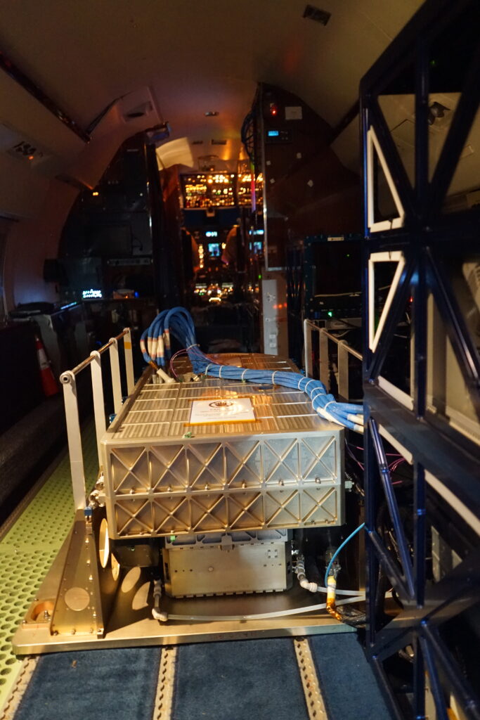
The HSRL-2 instrument onboard the G-III. (Credit: Jonas Von Bismarck / ESA).
Flight planning at the resort
My day starts with waking up at the resort. It is light outside as it is already well into the afternoon. Opening my curtains, I see ‘The Causeway’ towards the airport knowing that I will take off there again tonight. I start preparing for the daily meeting about weather forecast and flight planning: I download the ECMWF and CAMS aerosol forecast images provided on a special campaign support page, overplotting the one or two possible nighttime overpasses and evaluating the best conditions to measure. In the daily meeting, Rich Ferrare presents his interpretation of the aerosol forecasts, local weather reports for the public and for air traffic, and even the local webcam. After an online discussion of the two, sometimes three, possibilities, the flight plan for tonight is drafted.
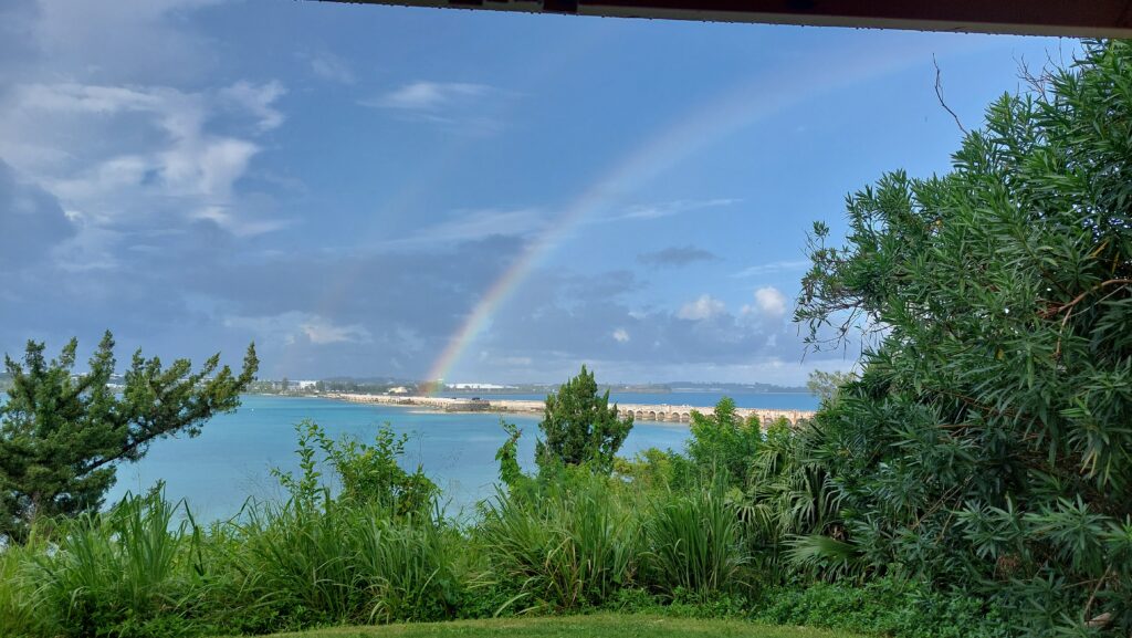
View from the resort over the Causeway at the airport. (Credit: Diko Hemminga / KNMI).
After the meeting, we usually have dinner at The Swizzle Inn next door to the resort. Their signature cocktail ‘The Swizzle’ is left alone by us though, as there is work to do tonight. (On my last night of the campaign, we would have dinner at the location of the local webcam from the weather briefings: St. George’s, the first permanent English settlement on Bermuda.) After a moment of rest after dinner, a swarm of buzzing scooters (description due to Taylor Shingler) leaves somewhere around midnight: the resort guests have gone to sleep, the roads are empty, and the airport is (almost) deserted. Often the trip was windy, especially over The Causeway, but I got quite lucky with the lack of rain while driving on the scooter.
Preparing for take-off
Luckily, some people are already at the airport. We are let into the building by a friendly man who always asks if we had any local specialties tonight, such as fish sandwiches or The Swizzle. NASA aircraft mechanics Elisa and Rob are already at work performing all necessary preparations for us to have a safe flight. On the plane I get in a flight suit combined with a jumper and thick socks, already knowing it gets cold on the plane. Setting the temperature inside the plane is a ‘science’ performed by the pilots following the requests from us to keep the instrument (and us) comfortable.
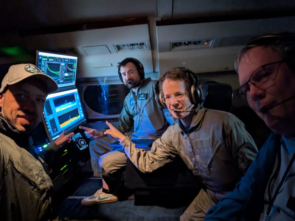
From left to right: Jonas von Bismarck, Taylor Shingler, Diko Hemminga and John Hair during a NightBLUE flight. (Credit: Jonas Von Bismarck / ESA).
Flying to catch EarthCARE
Shortly after a smooth take-off, flying over the ocean, the viewport on the bottom of the plane is opened and HSRL-2 is turned on. The flight towards the EarthCARE track begins. While keeping an eye on the instrument and data coming in, it is time for snacks (stocked up by John Hair), music trivia, jokes, and riddles with the pilots joining in as well. There is even an option to make coffee on the plane. Taylor shows his expertise in all these fields.
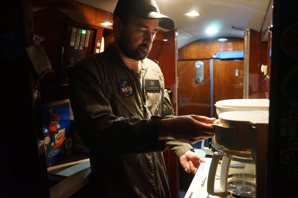
Taylor making coffee during a night flight. (Credit: Jonas Von Bismarck / ESA).
With the EarthCARE track coming close, the automatic calibration sequence of the HSRL-2 instrument is performed one more time before the underflight of EarthCARE starts. During the NightBLUE campaign, we performed the 100th underflight of EarthCARE, which underlines the effort undertaken for the calibration and validation of EarthCARE’s instruments. The moment of tension during the exact overpass of EarthCARE over the aircraft is relieved by jokingly trying to look up from the plane to spot EarthCARE.
Measurements of the atmosphere and ocean by two collocated instruments
Overall, the underflights have been very successful; we were able to measure a range of conditions: marine, smoke and pollution aerosols likely originating from North America and even dust from the Sahara transported over the Atlantic Ocean by tropical storms, as well as low-altitude water clouds and high-altitude ice clouds. After half an hour to an hour on the EarthCARE track, it is time to turn back towards Bermuda. As soon as the plane starts turning, another calibration is performed, as the measurements would be off nadir anyway.
Close to Bermuda, our flight targets another science topic. An overpass back and forth is flown over the underwater track of an ocean glider instrument from the University of Delaware, which will enable comparison of the oceanic measurements with lidar ocean returns in the future.
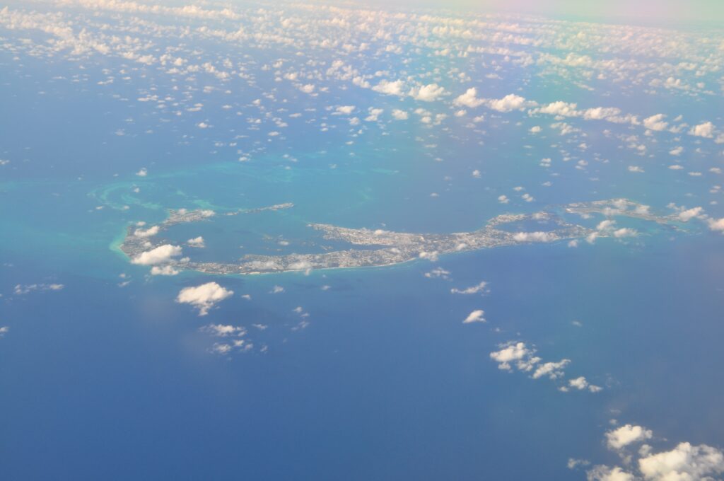
Aerial view of Bermuda. (Credit: John Hair / NASA).
Another good night(flight) comes to an end
As the cherry on top, twice I was allowed to experience the decline and landing from the jump seat just behind the pilots, who have an amazing view. After a smooth landing, it’s time to face the hot humid air outside again; quite different from the inside of the airplane. As I return back to the hotel, the Sun is coming up and we can be satisfied with another successful EarthCARE validation flight, so it’s time to go to sleep.

View from the cockpit during landing. (Credit: Jonas Von Bismarck / ESA).
Recap of the action
In total, the NightBLUE campaign contained eleven nighttime underflights, honoring the campaign name, and five daytime underflights. The campaign also included a consecutive underflight of both EarthCARE and NASA’s PACE satellite, in the daytime. With the preliminary data available, there is much analysis to do. The first results of comparisons for ATLID L1b and L2a validation are planned to be presented at the upcoming EarthCARE science and validation conference in Tokyo in December 2025.
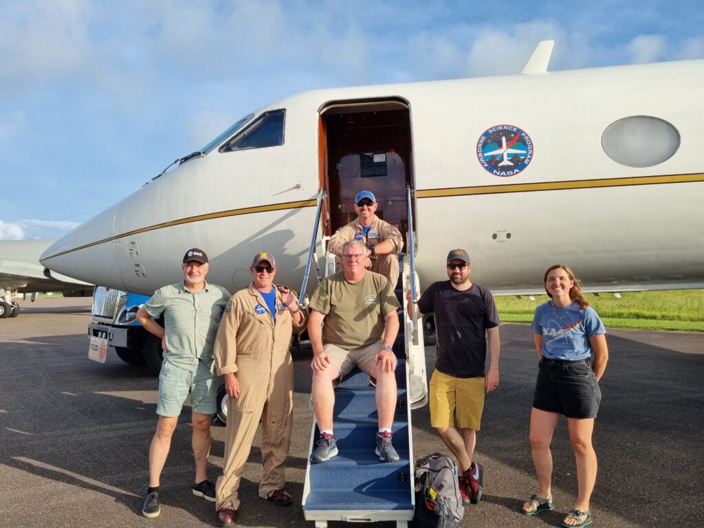
Flight crew after a daytime flight. (Credit: Dave Donovan / KNMI).
Discussion: no comments