Flying an Earth Explorer mission like EarthCARE, ESA’s cloud and aerosol mission, is a truly international effort.
Not only is its cloud profiling radar provided by JAXA, but campaigns to calibrate and validate each and every one of EarthCARE’s complex suite of four instruments are taking place from Cape Verde to Canada.
Most recently, the EarthCARE Commissioning Cal/Val Campaign in Ottawa (ECALOT) took off to measure clouds and aerosols as EarthCARE flew overhead – fighting against a huge solar storm in the process.
Environment and Climate Change Canada’s (ECCC) Zhipeng Qu takes us through what it takes to run a calibration and validation campaign, why it’s important, as well as some eventful flights shedding light on the mysteries of clouds over Ottawa, Canada.
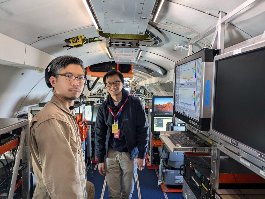
Zhipeng (centre) with colleague Cuong Nguyen during one of the EarthCARE underflights. (National Research Council Canada-Paloma Borque)
Introducing ECALOT
EarthCARE is currently in commissioning phase, during which all of its instruments -the cloud profiling radar, atmospheric lidar, broadband radiometer and multispectral imager- have been turned on and delivered their first combined results.
Those instruments are all working together to help scientists understand the role clouds and aerosols play in regulating Earth’s climate.
Once data becomes available for scientific use in January 2025, it’s essential that it is of the best possible quality. That means we must gather essential observational data using aircraft and surface instruments to calibrate and validate EarthCARE data products.
This involves coordinating flight paths to align with satellite overpasses and conducting sampling of the surrounding regions, supported by surface observation sites.
The collected observational data will also enhance numerical weather prediction (NWP) models, such as the cloud microphysical scheme and radiative transfer scheme.
Clouds and aerosols, after all, are still one of the biggest mysteries in our climate system.
EarthCARE surfs the geomagnetic storm
Two flights have been conducted so far, on 1 October and 10 October, during which the aircraft observed clouds and aerosols aligned with EarthCARE’s overpasses.
The flight on 10 October was notable, not least because of the huge geomagnetic storm that was happening at the same time. This kept the ESA team flying EarthCARE on their toes, as manoeuvres had to be planned to account for the solar activity.
All these things have to be taken into account if we are to match our flight path with EarthCARE’s track as it orbits above us at 393 km – a low Earth orbit that means the satellite must surf against increased satellite drag during solar storms.
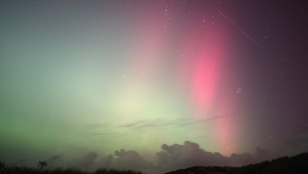
A satellite (not EarthCARE) crosses the northern lights illuminating the night sky over Hunstanton, UK, during the geomagnetic storm of 10 October 2024. (EJR-Quartz/European Space Agency-Peter Bickerton)
Weather watching over Ottawa
We are flying the National Research Council Canada’s (NRC) Convair-580 aircraft, which is based at Ottawa International Airport, in a radius of about 350 km around Canada’s capital.
The aircraft carries a W-band radar and two 355 nm lidars (one pointing up and one pointing down), which are similar to EarthCARE’s radar and lidar, as well as in-situ cloud and aerosols probes, an X-band radar, microwave remote sensing instruments and atmospheric probes for temperature and humidity.
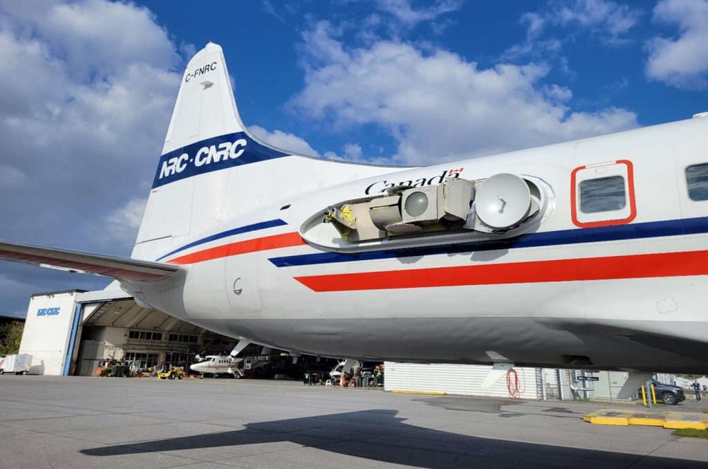
The radar antenna system of NRC’s Convair-580 aircraft. (National Research Council Canada – Cuong Nguyen)
The autumn season in Canada offers some particularly beautiful sights from the plane, as the red, orange and golden leaves out on a stunning show to rival that of the northern lights.
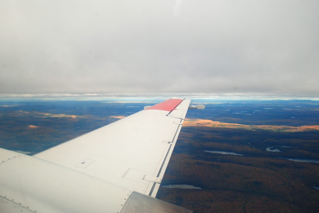
Autumn leaves provide a spectacular view from the aircraft. (Environment and Climate Change Canada-Zhipeng Qu)
There are other interesting views, too, such as a glory that we spotted during one of the flights.
A glory is a phenomenon often encountered by mountaineers, when it is known as the Spectre of the Brocken. It looks a little bit like a halo around the shadow of the observer, in this case our plane, and it’s caused by sunlight shining through the tiny water droplets in clouds.
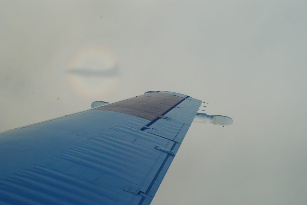
A glory observed from the Convair-580 aircraft. (Environment and Climate Change Canada-Zhipeng Qu)
Validating EarthCARE measurements and weather prediction models
During the ECALOT campaign, we hope to encounter a number of different weather conditions, including
The first flight on 1 October travelled northwest of Ottawa, where there were cumulus and stratocumulus clouds, the cloud top reaching 2.7 km in altitude and the cloud base at around 1 km.
The second flight on 10 October went northeast of Ottawa, where we encountered stratocumulus clouds, with a lower cloud top at around 1.7 km and the cloud base at around 1.4 km.
In both cases, we saw widespread stratiform liquid clouds in the north of the Ottawa region. The flights focused on sampling these liquid clouds for the validation of EarthCARE’s liquid cloud retrieval algorithm, both single- and multi-instrument.
In addition to ensuring valid cloud retrieval, the under-flight paths were designed with a 20° offset across the satellite orbit, to validate EarthCARE’s 3D scene construction algorithm in the off-nadir region.
These observations will play a crucial role in validating the satellite’s instruments and retrieval algorithms, as well as enhancing the accuracy ECCC’s Global Environmental Multi-scale Model for numerical weather prediction simulations.
Additional flights are scheduled for later in October and November 2024.
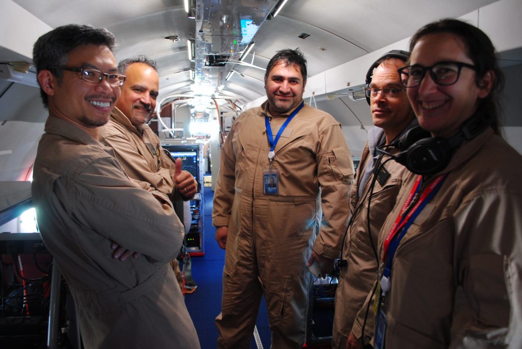
The NRC team aboard the Convair-580 during a flight. (Environment and Climate Change Canada-Zhipeng Qu)
Cloud gazing from the ground
The campaign also relies on ground measurements from a surface network called Climate Sentinels operated by McGill University and the Université du Québec à Montréal (UQAM). In addition, our colleagues at ECCC and McGill University set up together a range of instruments at Ottawa airport in late August.
The kit includes Doppler lidars, a microwave radiometer for temperature and humidity, an Atmospheric Emitted Radiance Interferometer (AERI), a net radiometer, a micro rain radar, a Parsivel present weather sensor, and other weather sensors.
When the hard work is done, and there’s time to kill as you await the results of instrument tests, is there anything better than to lie back under the summer sun and watch the clouds pass by?
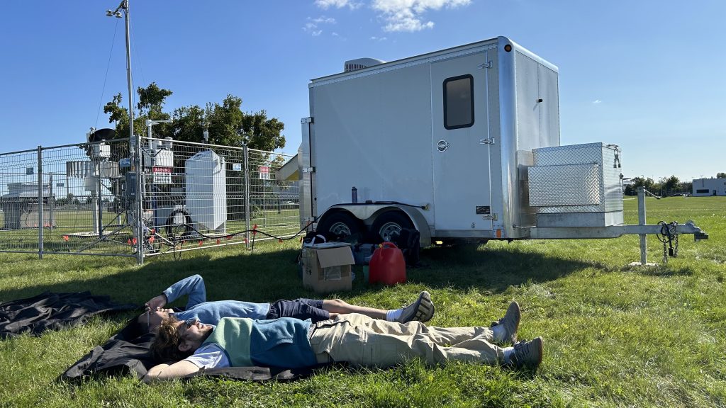
Benjamin Riot-Bretêcher and Lei Liu of McGill University doing a spot of cloud-gazing after installing instruments. (McGill University-Eve Bigras)
More on ECALOT
The ECALOT campaign is a collaborative effort with contributions from Environment and Climate Change Canada (ECCC), National Research Council Canada (NRC) and academic research institutes including McGill University, the Université du Québec à Montréal (UQAM) and the University of Toronto (UofT).
All partners bring extensive experience in atmospheric observation and satellite Cal/Val. Additionally, ECCC has actively contributed to the development of EarthCARE‘s Level 2 radiative closure processors, enhancing the capabilities for the current Cal/Val efforts.


Discussion: no comments