We have been following the scientists of the ORCESTRA campaign, who have taken to the air, ocean, and the islands of Cape Verde and Barbados, to gain a deeper understanding of tropical storms. Hundreds of researchers from institutes either side of the Atlantic have taken part in an exquisite piece of international coordination -braving turbulence and sea sickness along the way- which has the added advantage of calibrating and validating EarthCARE measurements.
Each of the planes, ships, drones, balloons, and ground stations, is equipped with instruments that complement EarthCARE’s cloud radar, atmospheric lidar, broadband radiometer, and multispectral imager. As EarthCARE flies overhead, they’ve been helping us get simultaneous measurements to take ESA’s cloud and aerosol mission through commissioning phase and on to operational use.
In our latest update we join Peristera Paschou, a PhD student at the National Observatory of Athens, who has been operating a lidar instrument aboard the Meteor Research Vessel – part of the BOW-TIE element of the ORCESTRA campaign.
She helps us to understand what it’s like to be a scientist on a research vessel sailing through storms -on purpose- in the middle of the ocean!
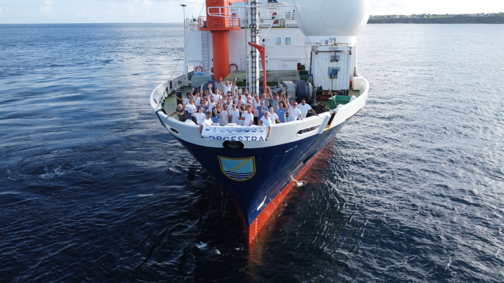
The crew of the Meteor as the ship finally arrives in Barbados. (TU Delft-O. O’Driscoll)
Six weeks on the choppy sea
Participating in a shipborne experimental campaign is a unique experience. We’re studying the impact of convection in the atmosphere, the ocean, and their interface, as well as validating the ESA Earth Explorer mission, EarthCARE, which was launched into orbit earlier this year.
For this campaign, atmospheric scientists, marine biologists, and oceanographers comprised a group of 27 scientists who boarded the Meteor for their six-week cruise from Cabo Verde to Barbados. After fighting with seasickness in the first days, this exciting trip started to unfold.
With the Meteor heading directly towards deep convection (and rain) inside the intertropical convergence zone (ICTZ), some of us are still fighting with seasickness during the storms and windy conditions. But it allows the multiple instruments onboard Meteor to perform measurements under such conditions.
A rainproof jacket is the “must have” during this cruise!
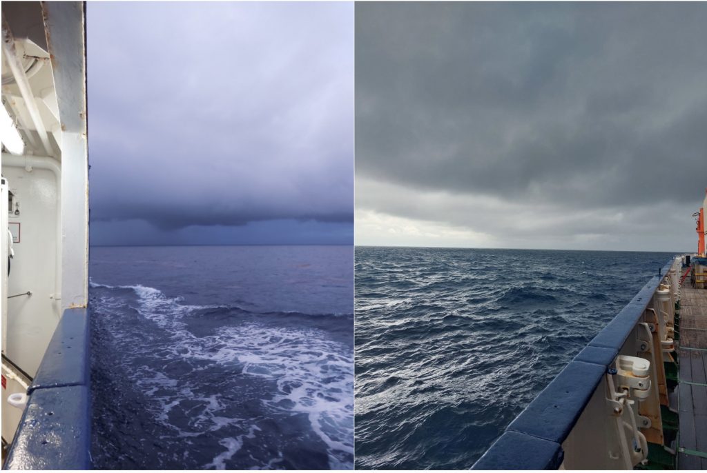
Two days with strong convection in the Atlantic intertropical convergence zone. (National Observatory of Athens-P. Paschou)
Operating the LICHT lidar
The LICHT lidar is a Raman lidar system suitable for automated 24/7 operation for monitoring aerosols, clouds, and atmospheric parameters like temperature and relative humidity.
Sound familiar? The instrument’s measurements will help validate EarthCARE’s ATLID lidar, which will also take measurements of clouds and aerosols.
The daily routine involves daily checks of the instrument performance, and maintenance procedures, like washing the windows that cover the laser and telescopes.
“Office” work is still needed to be done for analysing the data, keeping in touch with the outside world by checking the mailbox, and producing visualisation plots for the campaign.
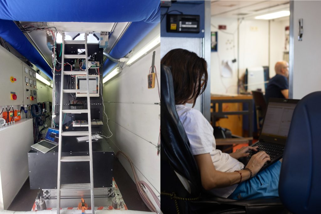
Left: the container office for hands-on work on the lidar system (National Observatory of Athens-P. Paschou). Right: the lab office for working with the lidar data on the laptop (TU Delft-G. George)
Meeting HALO and EarthCARE
To emphasise the coordination of a campaign like ORCESTRA, it involved the Meteor zigzagging through the ocean, while teams flying research aircraft like the DLR HALO flew directly overhead.
The images below show the moment the HALO aircraft from the PERCUSION part of the campaign flew overhead, collecting collocated measurements for synergistic studies on aerosols and clouds within the ITCZ using shipborne and airborne lidar measurements, as well as validating ATLID lidar products onboard EarthCARE.
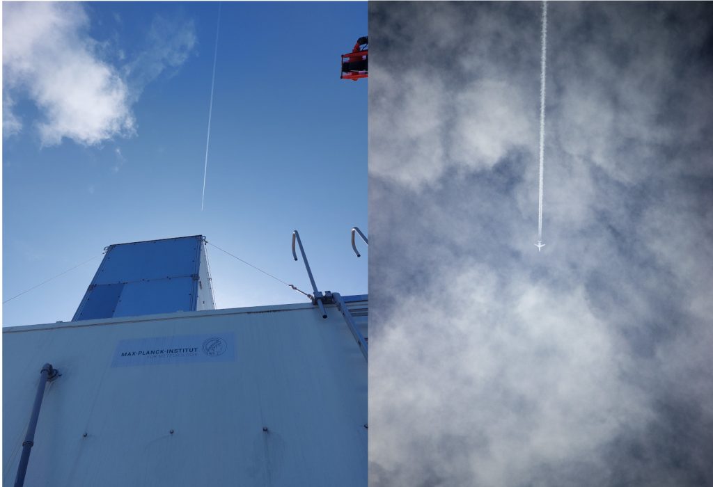
Measuring with LICHT lidar during HALO overflights, of which you can see the contrails, and EarthCARE overpasses. (left: National Observatory of Athens-P. Paschou. Right: TU Delft-G. George)
Below is a time–height plot of the particle backscatter coefficient at 532 nm measured by the LICHT lidar on Saturday 31 August 2024, providing a quick overview of the aerosol and cloud conditions along the ship’s track. The DLR HALO overflew the Meteor’s location two times (red lines at 10:00 and 14:00 UTC) and EarthCARE overpassed us at 15:40 UTC (magenta line).
Teamwork!
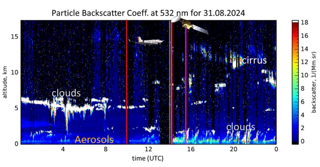
A time – height plot of the particle backscatter coefficient at 532 nm measured by the LICHT lidar on Saturday 31 August 2024 (National Observatory of Athens-P. Paschou)
Free time activities
Of course, not every hour in this demanding six-week cruise is dedicated to science. We all need some free time, after the end of our working hours, to relax and re-charge our “batteries” for the next day/shift.
One would think that there are not so many things to do on ship, but we are very happy to prove them wrong. Many of us practised our fishing skills or even tried fishing for the first time during our stops close to the PIRATA (Prediction and Research Moored Array in the Tropical Atlantic) buoys where oceanographers and marine biologists were performing their own measurements.
For those that were more interested in sports, a well-equipped gym, some tabata workout sessions, and table tennis could help them enjoy exercising on the open water. There is also a special room for book and music lovers, with many options for science and literature books, and two guitars with which a blues duet was played.
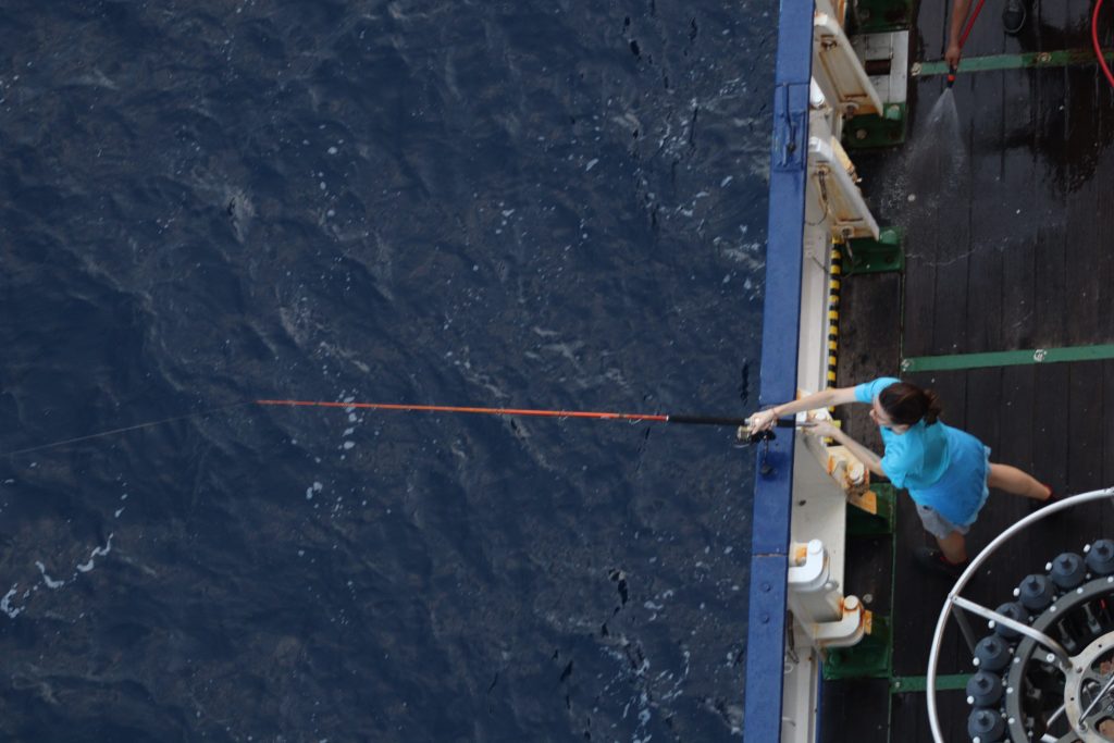
Exploring fishing techniques in open water. (Sorbonne Université-J. Habib)
And for all of us, plenty of beautiful sunsets with the sun diving into the ocean created worth-while and lasting memories.
Below, you can see a picture from when we were admiring the magic of the night in the middle of the Atlantic Ocean: looking at the fancy green beam from the lidar in cloudy skies, admiring the stars and our milky way galaxy in adequately clear sky conditions (a break from our hunting for deep convection) to the rising of a full moon from the ocean surface, always accompanied by the “sleepless” LICHT lidar which keeps taking measurements even though some of us are sleeping, relaxing from a long day or a night shift.
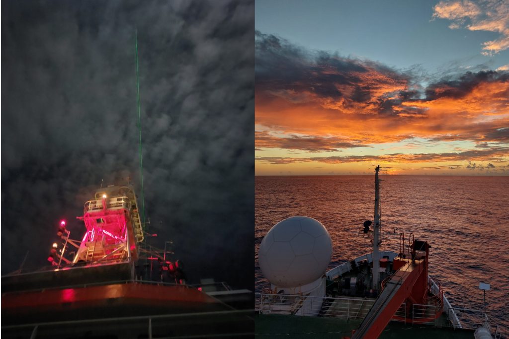
Left: The green beam of the LICHT lidar pointing to the sky on a cloudy night. Right: One of the many colourful and cloudy sunsets. (National Observatory of Athens-P. Paschou)
Thanks to Peristera Paschou of the National Observatory of Athens for this blog, and to the ORCESTRA campaign. Peristera’s work on the validation of EarthCARE ATLID lidar with LICHT lidar measurements is co-funded by the European Union in the framework of the Pangea4CalVal project. Peristera’s participation in ORCESTRA was funded by the Max Planck Institute. You can find out more about EarthCARE on the ESA website.


Discussion: no comments