


Last year, the AMT4SentinelFRM Research Voyage set sail from Immingham on 20 September 2016 aboard the British Antarctic Survey ship, the Royal Research Ship James Clark Ross, and arrived some 7 weeks later on 2 November 2016 in the Falkland Islands. The research cruise covered 8000 miles of ocean, and collected more than a million measurements of surface ocean colour optical properties, surface temperature and wave motion.
Among the multitude of measurements, scientists from Plymouth Marine Laboratory (PML), University of Southampton (UoS) and IFREMER obtained almost 2000 match-ups with Sentinel. AMT4SentinelFRM uses the UK’s Natural Environment Research Atlantic National Capability, the Atlantic Meridional Transect which has a long history of use for satellite ocean colour validation for NASA and ESA missions.
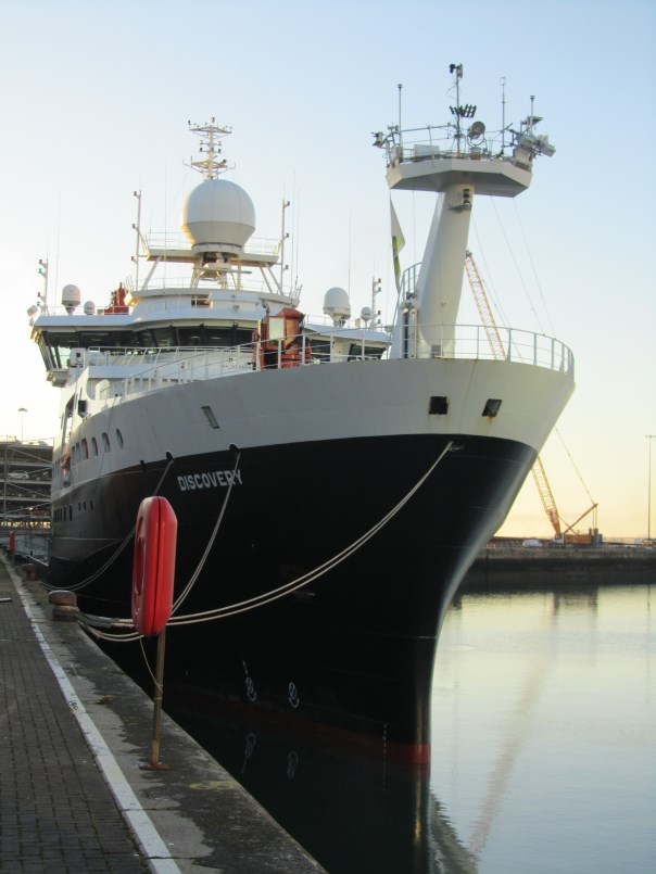
The Discovery in Southampton Port on 21 October 2017. (Credits: PML)
This year, the second AMT4SentinelFRM voyage set sail on 23 September. Mobilisation for the cruise started at the beginning of August with new equipment being manufactured to improve on last year’s operations and measurements. Gavin Tilstone and Francesco Nencioli from PML are running the optical instruments for the validation of Sentinel ocean colour, Werenfrid Wimmer from UoS is running the Infrared radiometers and Peter Sutherland from IFREMER joined the ship in port to install the c-band radar system that characterises wave properties that are detected by the Copernicus Sentinel-1 satellite.
This year, they have also been joined by Quinten Van Hellemont from the Royal Belgian Institute of Natural Sciences and Krista Alikas from the Tartu Observatory, Estonia who, together with the PML optics team, are comparing long-track and on-station above water radiometric measurements using different sensors.
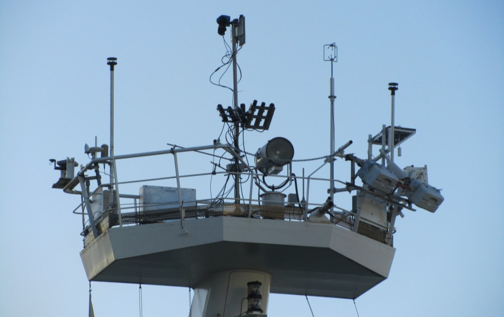
Met Platform (Credits: PML)
These sensors are designed to retrieve the spectral distribution of upwelling radiance just above the sea surface that is then used to estimate the chlorophyll-a concentration as a proxy of phytoplankton biomass. The comparisons between PML, RBINS and TO radiometers help to understand the effects of different instrument design on the upwelling radiance which helps to provide confidence in data products.
To facilitate these comparisons, PML designed a purpose built stainless steel frame to locate all of the sensors at the same viewing geometry so that they receive upwelling radiance from the same patch of water. This and the ISAR that Werenfrid is operating and the IFREMER radar system are all installed on the ship’s met platform, that is approximately 5 meters above the fore deck and has an unrestricted view of the ocean.
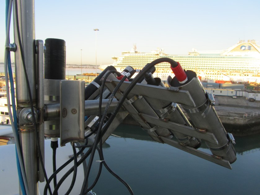
Close up of the Plymouth Marine Laboratory (Credits: PML)
This suite of instruments provides an autonomous, continuous data stream of the sea conditions and optical properties that will be used to validate the fleet of Copernicus Sentinel satellites. These measurements are being used to verify the accuracy of the Sentinel satellites products so that the highest quality data can be distributed to end user to facilitate environmental monitoring of our blue planet.
Post from Gavin Tilstone (PML)
Discussion: no comments