


In the evening of Tuesday 18 November our plane took off from Cape Town heading south to our final destination: Antarctica. Researchers from India, Belgium, the UK, and Finland, as well as a group of tourists were also on board.
We are prepared to leave for the field camp, which will be placed about 70 km southeast of Novo Airbase. To transport the gear to set up the field camp we are supported by a Prinoth Everest snow groomer. (TUD)
The Ilyushin 76TD is a heavy-cargo aircraft, having no windows but a screen to show pictures of an outboard camera. From the pilot’s perspective we could watch the start as well as the soft
landing six hours later on the ice runway at Novo Airbase. About an hour before landing we had to put on our polar clothing. Given the limited space, this was a bit of a shambolic affair. Nevertheless, everybody finally managed to manoeuvre arms and legs into the correct openings of the polar suits.
In -12°C and a wind speed of 35 km/h we helped unload the aircraft. The freight was sorted according to its final destination and then we could move into our new temporary home, a container mounted on skids.
While the other passengers were about to take their ferry flights to their stations, we began to prepare for the next stage of our expedition. We checked the generator, set up the tents, and controlled our scientific equipment.
Also, we established geodetic GPS stations at bedrock. They should record data for almost the entire time of our expedition. Serving as reference stations, the acquired data will help to precisely analyse the kinematically measured height profiles. GPS receivers are now running in the Schirmacher Oasis and at an outcrop near Novo Airbase.
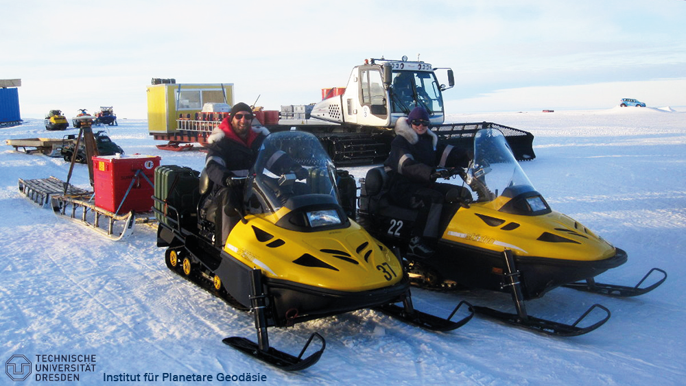
On the way to these sites we could also perform a first check of our kinematic GPS set-up. Pulled by snowmobile, the Nansen sledge is almost four metres long. The kinematic GPS antenna is permanently mounted on the sledge so that GPS data can be recorded while driving.
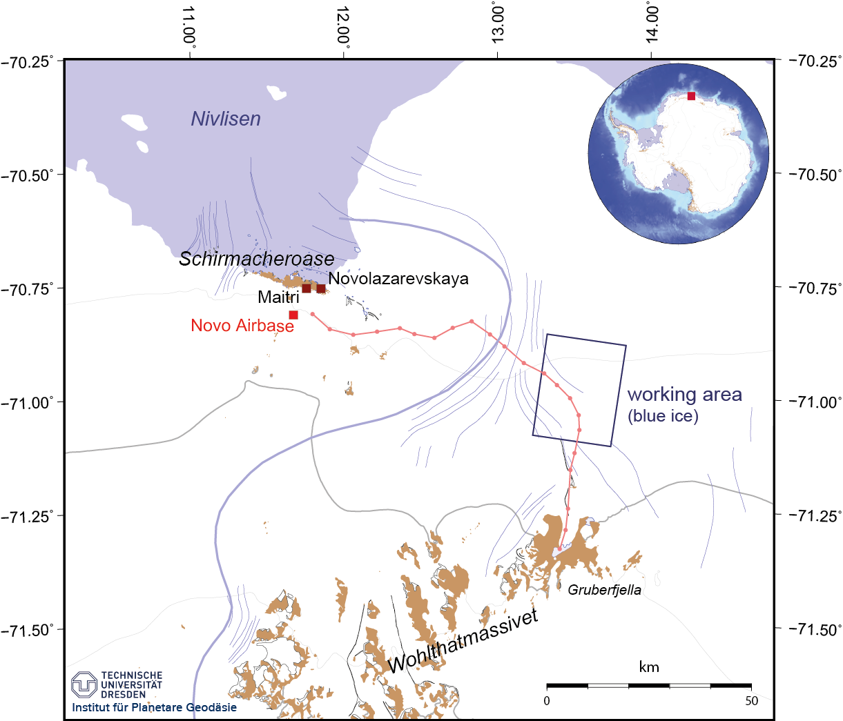
Overview map of our working area. The area comprising Schirmacher Oasis, blue ice region and Wohlthat Massif is situated in central Dronning Maud Land, Atlantic sector of East Antarctica. (TUD)
Our preparations are almost complete now. On Tuesday (25 Nov) we plan to leave Novo Airbase and to head for our field camp about 70 km southeast. We’ll stay there for the next weeks to realise our geodetic field programme.
Now we are well used to the climatic conditions. What after the arrival from South Africa appeared to us as biting, icy wind, we now consider as normal conditions!
Post from: Ludwig Schröder and Undine Strößenreuther from TU Dresden in Antarctica as part of ongoing efforts to validate ESA’s CryoSat mission.
Discussion: no comments