From Chris Derksen (Environment Canada) 22 April 2013
Following completion of the SnowSAR flights and ground measurements near Inuvik, the entire operation transferred to Alaska.
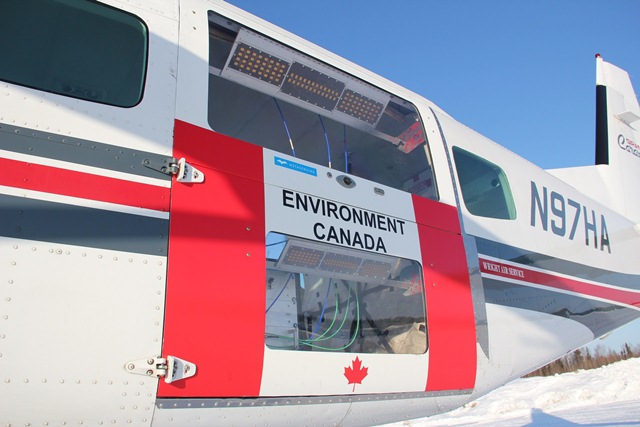
This included a rather complicated effort to ship the SnowSAR and aircraft installation (modified aft baggage doors for the Cessna-208 Grand Caravan) fromInuvik,Northwest Territoriesacross the border toFairbanks, Alaska.
Although these two communities are only separated by about 500 km by air, they are not efficiently connected either by air or ground. TheAlaskaand Environment Canada field crews made the nearly 3000 km road trip, starting with a southbound drive on the infamous Dempster highway to DawsonCity.
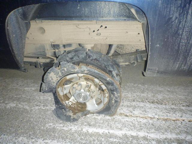
The Dempster, with its rough gravel surface, is known for eating tires, and the Environment Canada truck did not emerge unscathed.
Nevertheless, three days after leaving Inuvik we crossed the Atigun Pass, through to the north slope ofAlaska, and arrived at theToolikLakefield station, operated by theUniversityofAlaska–Fairbanks.
Unfortunately, the shipping of the radar and aircraft doors toFairbanksdid not go smoothly. Owing to a series of missed steps beyond our control, the projected timeline for conducting the SnowSAR flights continued to slip.
Fortunately, our luck turned and thanks to some quick processing of our shipment by United States Customs. The SnowSAR instrumentation arrived safely inFairbanks, where the MetaSensing operator was waiting for the installation onboard a Cessna 208. The customised cargo doors for the SnowSAR antennas (X-band on the top window, and Ku-band on the bottom) can be readily interchanged among different C208 aircraft platforms, so we were ready for science flights on 18 and 19 April.
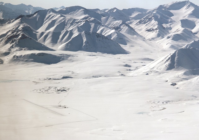
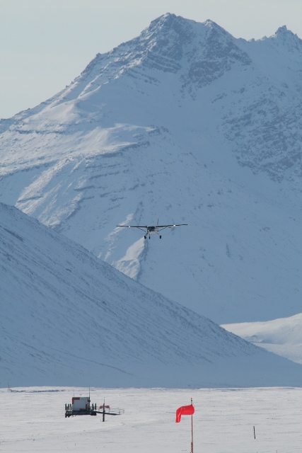
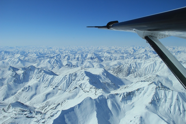
The acquisition site was 600 km north ofFairbanks, and was reached with a 1.5 hour ferry flight. Before beginning the radar acquisitions, a short stop and go was performed at a small landing strip (nearGalbraithLake, at the north end of theBrooks Range) for coordination with the ground team.
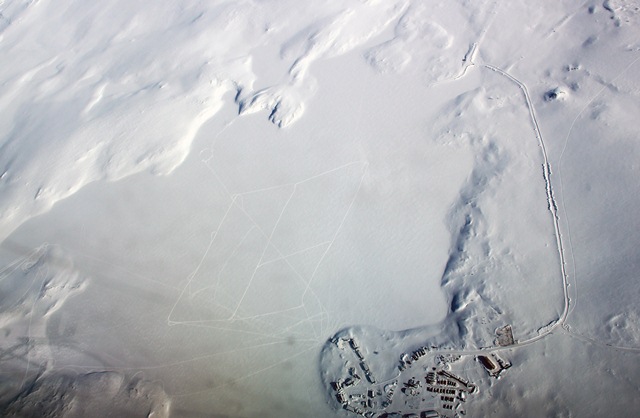
The SnowSAR acquisitions began overToolikLake, where 12 corner reflectors were placed for radiometric calibration.
The tracks left by the snowmobiles reveal the locations of the targets in three parallel lines, one for the co-pol corners, one for the cross-pol at X band, and one for the cross-pol at Ku-band. The field station facilities can be seen in the bottom right of the aerial image.
Our American colleagues had already started the snow measurements in the Imnaviat Creek watershed, which included an intensive 1 km by 1 km grid of snow survey lines.
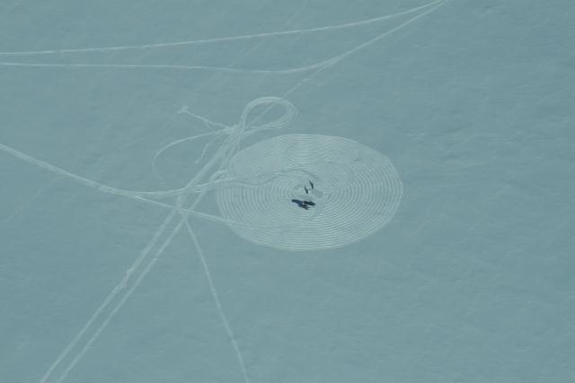
One unique aspect of these ground measurements was a FMCW radar (designed, built, and operated by Dr. H-P Marshall,BoiseStateUniversity) operating in the same frequencies as the SnowSAR. This instrument was also deployed during SnowSAR flights inAustriain February. In the photos below, you can see 1 km snow survey lines (separated by 100 m) and ‘crop circle’ patterns where the FMCW acquired measurements in a spiral pattern.
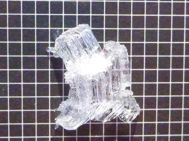
The snow cover properties at Imnaviat Creek inAlaskawere markedly different from Trail Valley Creek nearInuvik. Meteorological conditions combined to create a depth hoar layer at Imnaviat that was remarkable. These large faceted grains are found at the bottom of the snowpack, and form as a result of temperature-induced vapor pressure gradients in snow. In over 30 years of snow surveys at Imnaviat, our colleague Matthew Sturm noted that he had never seen depth hoar crystals as large as what we measured this year. The grid spacing in the photo below is 2 mm, so this depth hoar crystal was approximately 14 x 12 mm in size. The impact of these large crystals on the airborne SnowSAR measurements will be important to determine.
Despite some stressful moments when our timeline was slipping, in the end we managed to acquire nearly coincident airborne SnowSAR and LiDAR measurements, with detailed ground-based surveys, in harsh Arctic environments, in two countries, separated by only 8 days. More than 15 hours of SnowSAR acquisition flights were achieved inAlaskaandCanadain the last two weeks, from which more than 250 SAR strip images will be obtained.
Over the coming months we will quality control all the ground measurements, and the final SnowSAR and LiDAR datasets will be processed. These various datasets will then be utilized to improve our knowledge of X- and Ku-band radar response to snow cover properties, and our ability to retrieve snow water equivalent (the amount of water stored in solid form by the snowpack) from these measurements.
Ultimately, we will combine our work with the analysis of SnowSAR data acquired inFinlandandAustria, to maintain the current momentum behind radar remote sensing of snow. Now that the melt season is imminent, the SnowSAR will take well deserved vacation…unti the next mission of course!
The success of this ambitious data acquisition plan (as well as the campaign periods in December and March) was due to the hard work of many people and organisations. A big thanks to:
- MetaSensing for the installation and operation of the SnowSAR, particularly Alex Coccia for his flexible travel schedule;
- Pilots and staff at North-Wright (Inuvik) and Wright’s Air Services (Fairbanks);
- Lake Central Aircraft Services for the development of a flexible aircraft installation for the SnowSAR;
- Staff at the Aurora Research Institute and Toolik Lake Field Station for their logistical support;
- The large group of participants who contributed to ground data collection, often under harsh Arctic conditions;
- EnvironmentCanada, the European Space Agency, and NASA Terrestrial Hydrology Program for financial and logistical support


Discussion: no comments