Elevation map of Antarctica. Credits: University of Minnesota
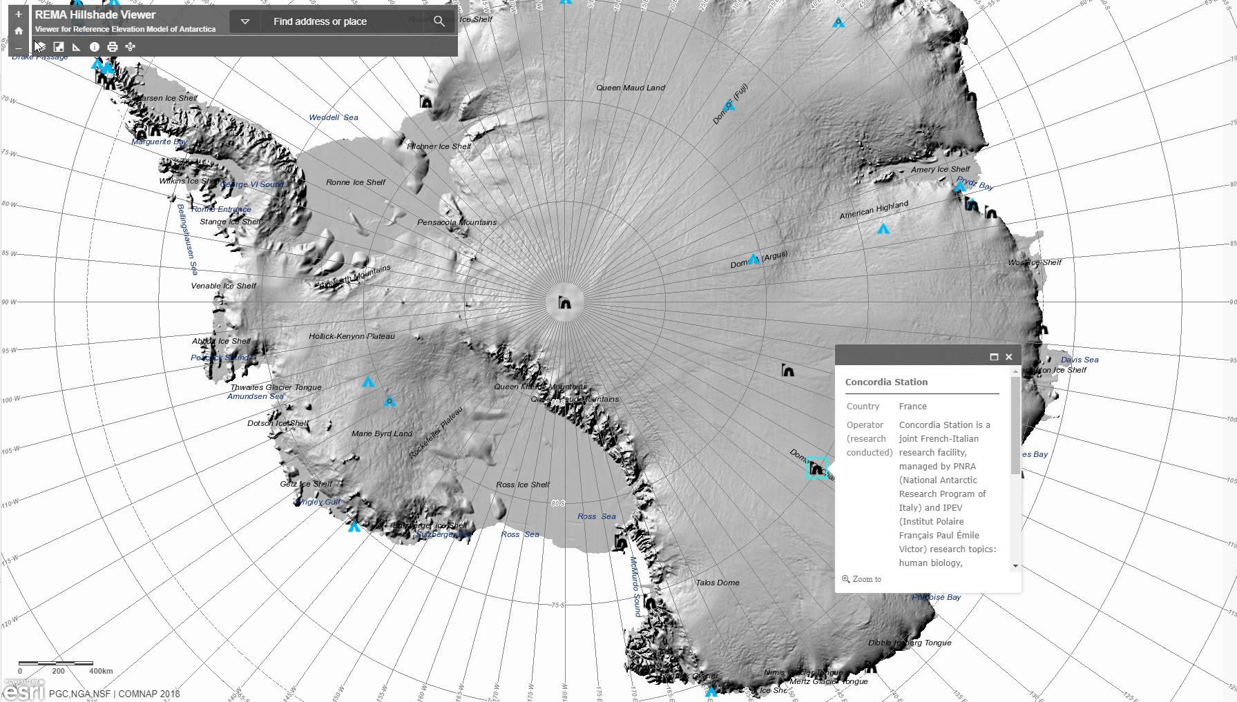
A great interactive map of Antarctica has been published that shows the elevation of Antarctica and its research stations. The map shows elevation data of the terrain down to eight meters. Made by a team from the University of Minnesota, USA, you can read more about how it was made in their blog or jump right in and try to find Concordia research station.
The map was constructed from hundreds of thousands of individual stereoscopic Digital Elevation Models extracted from pairs of submeter resolution DigitalGlobe satellite imagery, including data from WorldView-1, WorldView-2, and WorldView-3 acquired between 2009 and 2017, with most collected in 2015 and 2016. Each individual model was vertically registered to satellite altimetry measurements from ESA’s CryoSat and NASA’s ICESat satellite missions.
Concordia is a joint French-Italian inland Antarctic research station run by the French Polar Institute and Italian Antarctic Programme. Every year it hosts a human research protocol coordinated by ESA and Concordia partners, supplied by universities and research institutions from across Europe.

Dark night. Credits: ESA/IPEV/PNRA-B. Healey
As well as offering around 9 months of complete isolation, Concordia is located at around 3200 metres altitude, so the crew has to adapt to chronic hypobaric hypoxia – they live with a third less oxygen than is available at sea level.
During the Antarctic winter, the crew endures 4 months of complete darkness: the sun disappears from the beginning of May, and is not seen again until late August.
Living in isolation with a European crew of 13 and in the world’s most extreme environment creates an ideal opportunity to conduct research into the adaptation of human psychology and physiology.


Discussion: one comment
Would you please inform myself this question which is high high was eights station above sea level in Ellesworth land in Antarctica?