


Polar Explorers dream about making it to the North Pole on foot, but to do it in one day over the frozen surface of the Arctic Ocean –you’ve got to be kidding? That would be like having your cake and eating it. So we are going to try it from the air, starting from Canadian Forces Station Alert (CFS Alert), from the northernmost inhabited tip of Canada.
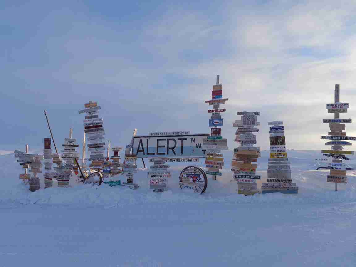
Sign at CFS Alert. (courtesy Mark Drinkwater, ESA)

The end of the inhabited Earth – panorama of landing strip at CFS Alert. (courtesy Mark Drinkwater, ESA)
We are going to get as close to the North Pole as possible in one day, within the range of the Twin Otter. Since we are in the air and not on foot, we thought we would try to make it a fair comparison. So as part of our very own scientific ‘Masterchef’ challenge we are going to make an Arctic layer cake whilst we fly, extending all the way to 86°N.
Our layers extend from the ground all the way up to space, with CryoSat measurements as the icing on top. The base of the cake is our Basler EM-Bird measurements of ice thickness – with its airborne torpedo flying through the air a few hundred metres above the ice. Our top layer of the cake, courtesy of NASA IceBridge, is the P-3 with its airborne topographic mapper and snow radar, flying at around 3000 feet. Meanwhile, the Norlandair Twin Otter will be the essential cream layer, sandwiched in the middle with the ASIRAS measurements to replicate CryoSat.
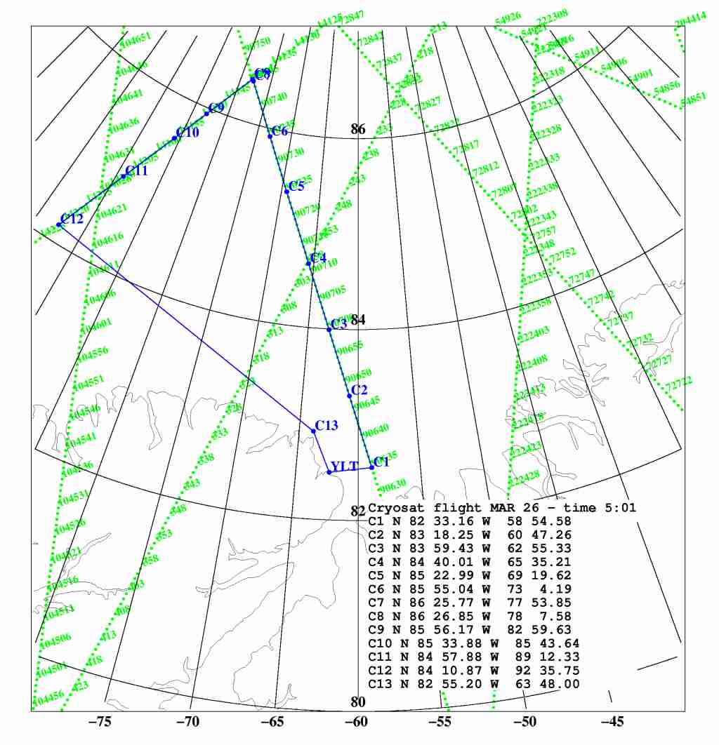
Flight plans from Alec Casey: base map + 25 March flight line (courtesy Rene Forsberg, DTU Space; John Sonntag, NASA; & Alec Casey, York Univ., Canada)
As you’ll have guessed by now, the cake is the world’s thickest – extending all the way up to the 717 km orbit altitude of ESA’s CryoSat satellite. Meanwhile we are going to slice the cake by cutting it along two CryoSat orbits. We fly northwest up along ascending orbit track (21011) from the opening of Nares Strait, east of Ellesmere Island to around 86.25°N, and then turn left to fly southwest along orbit track (20121) towards Axel Heiberg Island before turning left and returning to Alert with our slice of layered data.
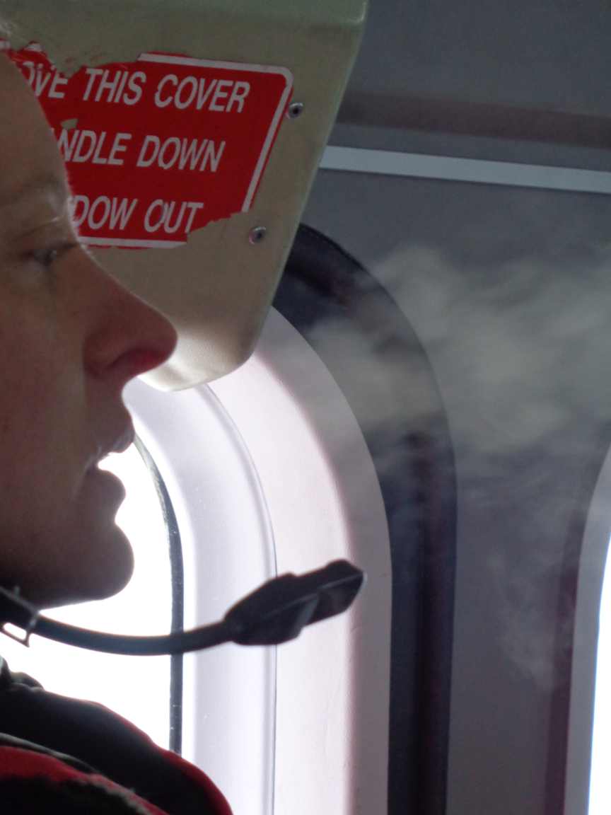
30° below zero on board & smoking breath – but no complaints. (courtesy Mark Drinkwater, ESA)
As we prepared to depart from Alert we were informed that the NASA P-3 was already underway along our combined measurement track. It had to set off earlier to be able make it back to Thule Airforce Base in Greenland before sundown.
First in line to take off from Alert was the Basler. After wheels up, York University scientists Alec Casey and Anne Bublitz have to deploy the EM-Bird sensor by lowering it by winch, before starting measurements. Since the Basler flies lower and slower, they set off earlier than the Twin Otter to obtain a head start. We took our turn last to refuel. We took off approximately a half hour later, played catch up along the CryoSat orbit track, adding the cream layer as fast as we could go.
The Basler equipped with EM-Bird flies slowly while making its low-slung measurements about 20 m above the deck. This offered the possibility of photographing her as we passed overhead. The excitement was palpable but short lived as the dark orange Basler appeared beneath us like a toy airplane model sitting on the white base layer of our cake. It energised us to continue our push onwards towards the Pole, braving the headwind and severe cold while cutting our cake.
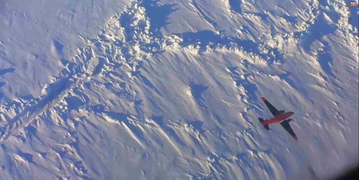
The Basler from above, taken from TF-POF Twin Otter. (courtesy Mark Drinkwater, ESA)
The journey today is over a mixture of seasonal sea ice (also known as first year ice), and perennial sea ice (multiyear ice). For sea ice to be able to survive the summer melt period it has to grow sufficiently thick during the winter growth season. Satellite observations have pointed to a dramatic reduction in total area of this old thick perennial sea ice.
The white expanse outside the window obviously belies the truth, and all available scientific data signals Arctic warming to be the culprit. Since 2010, CryoSat has observed the amount and volume of very thick ice to be diminishing, underlining the veracity of the trend in the amount of old ice. So our flight pattern has been carefully designed to cross an ice region containing varying amounts of old and young ice, with the objective to verify or validate what CryoSat has observes in terms of the pattern of ice thickness in this piece of the Arctic at the end of winter 2014.
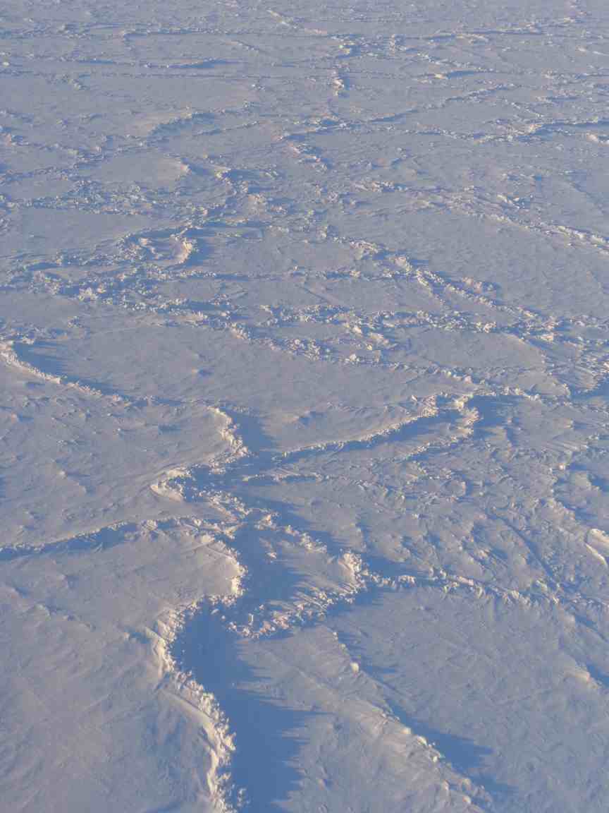
Arctic sea ice at 86°N. (courtesy Mark Drinkwater, ESA)
Whilst today’s mission didn’t make it to the Pole, I think we met our Arctic Masterchef challenge. And I am happy to pass along this recipe for our CryoVEx Arctic layer cake. Hopefully when the scientists lay their hands on some, they will find it to be excellent. It was certainly another memorable chapter of the ESA CryoVex 2014 campaign.
Post from Mark Drinkwater (ESA), Alert northern Canada, 26 March 2014.
Discussion: no comments